Picture a very wide and long table, embed a mountain into it and enlarge it a zillion times, and the result is Colorado’s Grand Mesa. It was Spanish explorers in the 1700’s who called the mountain “Mesa Grande”, meaning “large table”. Before more modern settlers came, the Ute Indian tribes living in the area called Grand Mesa “Thunder Mountain”, because of how the mesa towers over the valley 6,000′ below.
Just like the Book Cliffs along its north side and Colorado National Monument to the southwest, Grand Mesa completes the large plateau formations surrounding Grand Valley, which contains the cities of Grand Junction and the smaller communities of Fruita and Palisade.

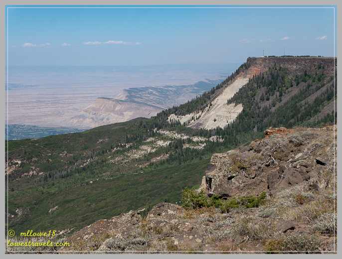
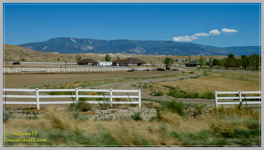
The unmistakable large mesa can’t be missed from the moment you drive into Grand Junction, either on I-70 heading East or from the south on US50. The 500-square-mile mesa has been called the world’s largest flat-topped mountain, standing over 11,000′ above sea level and 6,000′ above the Colorado River.
 We explored Grand Mesa in two visits; first the northern half by taking I-70 from Fruita to the Grand Mesa Scenic Byway, and on another day via US50 and CO65 from the south during our stay in Montrose.
Our first trip from Fruita found us on a steep climb east of Palisade, where we observed a large diversity in the landscape – from desert canyons to dense forests atop the mesa. We paused at several overlooks to take in the meadows and deep forests of Colorado Pine, Spruce, Fir and a multitude of lakes. Reaching the top, we could smell and feel the cool evergreen forests.


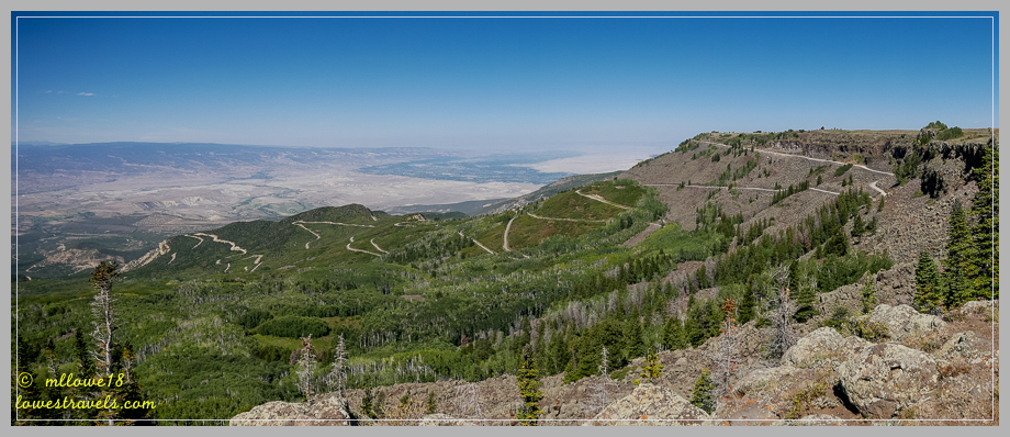
After a short hike on the Discovery Trail behind the visitor center, we went inside to peruse the displays and watch their short movie. We learned from a park ranger that we could drive out to Lands End Observatory, then follow Lands End Road down to US50 for our return to Fruita.
Although the road was gravel and a long drive, it was in decent shape and gave us fantastic views of the valley below as we descended. Since our plan was to return to the south end of the mesa from Montrose in a couple of weeks to hike Crag’s Crest Trail, this was a nice loop to drive on our first trip.

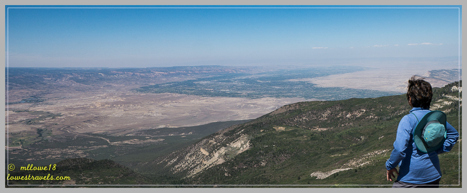
Land’s End Observatory is perched on the edge of Grand Mesa and offers panoramic views of the valley below, the La Sal Mountains in Utah to the west and the San Juan Mountains to the south. It was a bit hazy during our visit, but the views were still extraordinary.


Crag’s Crest Trail

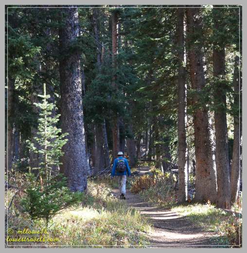
Our second visit to Grand Mesa was made with one goal in mind – to hike Crag’s Crest Trail which is located high atop the mesa. We waited for a couple of weeks in the hope of catching even more Aspen trees in all their Fall splendor. This popular trail is designated as a National Recreation Trail, with views extending in all directions. It can be hiked as a 10.3-mile loop, as a 6.5-mile roundtrip crest hike or as a lower portion 3.4-mile roundtrip trek. Unfortunately, the lower portion was closed indefinitely due to a Spruce Beetle epidemic when we were there, so doing the full loop was out.
We began our trek from the west trailhead, following the crest portion with a starting elevation of 10,360′. For the first two and a half miles, we huffed and puffed to the crest in the deep forests of Colorado Pine and Spruce. This was a bit higher than we’ve hiked in quite a while!


For the next two miles, we walked a narrow ridge flanked by dizzying drop-offs on both sides, with spectacular vistas all around. Tall mountain ranges were visible to the south, with golden Aspens shining brightly from the mountaintops and hillsides.


Embarrassing moment: Steve hiked ahead as I took pictures from an overlook, as usual. I somehow went the wrong way when I returned to the trail, and after a while, we both realized we had gotten hopelessly separated. With no cell signal, we couldn’t communicate and I ended up going almost a mile in the wrong direction! Of course, Steve eventually came looking for me, and we both wondered how I could get lost with all of the current GPS technology we use.
Lesson learned: After taking pictures I should pay attention to where the trail is headed and actually use some common sense! Duh! The good news is that we both added over a mile to our hikes as we searched for each other, and we’ve decided to call it a positive addition to our workout 😉


Hiking the ridge was amazing, and the full parking lot when we returned proved it’s a very popular trek. The crest rewarded us with the majesty of Colorado’s prized skyline, and the added bonus of golden Aspens dotting mountains as far as we could see.
Comments
24 responses to “Exploring the world’s largest flat mountain – Grand Mesa, CO”
I’m not sure we will be seeing fall colors this year so I am thankful for your posts. You two are really immersing yourself into Colorado. Your photos are gorgeous!
Boy I am so sorry we missed hiking this a second time. We will get to this trail yet!! Love the views from above especially the lovely lake. That’s quite an elevation gain. Great job! I didn’t quite understand Jeff’s comment on our post about the signs and your names sending you opposite ways. Now I get what he meant. I can’t believe you two got separated again. Thank goodness you found each other rather quickly. Enjoy Durango. Looks like it will clear by Tuesday!!
Too bad, you missed the trail the second time again! And looking at the weather you made the right decision of moving and heading south. GJ is slammed right now. I know, I cant believe I made the wrong turn and headed back to the trailhead. It was just a few minutes and half a mile later did I realize my mistake.
These photos are great MonaLiza, the beautiful aspen colors pop out like they were photoshoped but I know they weren’t! Such a beautiful place. We’re still trying to dodge the bad storms here in Texas and don’t think we’re going to make it to Caprock State Park….it’s under flood warnings til Monday afternoon! Sigh.
I know, we had been watching the weather and it looked like the Texas Panhandle is slammed! Be safe out there and try to stay dry.
That was some serious fall color and incredible views on the crag hike. I’d like to hike there some day!
I know you and Hans would love this trail.
Wow, those fall colors are fantastic! Such a pretty hike any time of the year, but fall in Colorado really is special. The views from the mesa are mind boggling. I have the Who’s “I can see for miles” running through my head as I look at these photos! I am always concerned that Kevin and I will get separated while hiking, but so far, he hasn’t lost track of me. Maybe we should staple GPS trackers to ourselves!! Anyway, glad you found one another and got some extra exercise.
Since you have hiked there, you must have asked yourself, how could I get lost? Had it been a loop it would have been easier to determine with All Trails app. But with an out and back, I really did not realize I was going back to the trailhead. After I relax a bit and half a mile later did I look at my phone and used my head that I was going the wrong way.
That is a huge mesa! So sorry you got shut out on the full loop trail and even sorrier it was because of the problem for the trees but what you did was quite a trek starting at over 10000 feet. That first forest opening is beautiful. You have more great phone apps than anyone I know. What fun to have the peaks identified for you. I’m amazed at the lakes and those golden views. Love your positive attitude about a wrong turn. You definitely got the fall color. It hasn’t happened here yet. Global Warming is giving us 90 degree temps in October. Previously unheard of.
I am liking my Peaks app, and glad there is one for out here in the west there are so many mountains! I was initially upset thinking Steve left me in the dust only to realize I was the one who made the wrong turn. We both laughed when I told him what happened and he said maybe I should take less pictures next time 🙂
What a beautiful area, looks like some great hiking! The fall colors were spectacular…..
Thank you, Colorado has their Aspen Gold!
Those fall colors are fantastic! Love those beautiful blue lakes dotting the landscape that you were looking down on. We’ve thought when we do our Colorado exploring that we’ll plan our visit for the fall. From your photos, it looks like the perfect time. And just so you don’t feel alone, left to my own navigation I will always head in the wrong direction. Glad Steve went back for you!! We don’t want to lose you! :-))
My next post will have more fall colors. Yes, I think after your gig in Lopez Island, plan to come this way on your way to Florida! We were both exasperated, for it was a an out and back trail, so imagine that!
Ha, maybe I shouldn’t admit it, but I could easily get lost on an out and back trail! 🙂
We loved the Crag Crest hike and did it twice when we spent a month in Cedaredge in June 2015. Would love to go back in the fall, but we did see a lot of wildflowers and even some left over snow.
Jim would not have been happy with me going the wrong way on the trail. Good that you had a sense of humor about it!
Steve was worried and thought I must have fallen from the edge 🙁 It was my mistake for not paying attention and taking too many pictures.
The fall colors are gorgeous, and one thing I will miss this year as our travels aren’t lining up that way for us. We will depend on you for our autumn splendor fix! Thank goodness you didn’t get more seriously lost/separated — that is one of my great fears when we are out there. Even though I knew it turned out OK, I still shuddered to read it. Good October scare!😱
That was the first time I made a wrong turn. Initially I was upset for I thought he left me in the dust and later on realized I made the wrong turn 🙂
What an amazing life you lead. It is with great pleasure I look forward to the upcoming photos you share with all. Thank you for the journey. You are Blessed…stay safe, breathe and never forget who looks after you.
Hope all is well health wise. Gloria and I are booked for 10 days all inclusive at Los Cabos Mexico in January. Not going south in the Beaver this year. Likely go somewhere warm n March as well.
Steve you got to google Navion aircraft and see the aircraft that was built by the company that built the P 51.
Mustang, This is a very exciting aircraft. I made an offer to purchase on a 1947 Navion that is in Van Nuys Ca.. This plane has a zero timed GO 480 Lycoming engine that is supercharged and puts out 340 HP.It has retractable gear and max speed is 220 mph.. This plane has a airframe time of 2700 hours with many modifications. The interior is new but it needs paint badly. Steve check out the Navion Society on the web.
I will be going to Van Nays on Oct 22 to be there when they do a Air Worthy Certificate for Export. I plan to get this plane flying painted and modified soon Have my Bush Caddy sitting on Amphibian Floats that I built this summer. Will fly it soon. RV 10 is still as it was two years ago. Plan to finish it in the near future. The Navion is a four place aircraft and it is plumbed for Oxygen and certified to 20,000 ft. I am enjoying this immensely and just hope my health continues as long as I have money to spend!
Stay safe I will fly to see you soon!
Matt
Thank you Matt, hope to see you too this winter.
Thank you Beverly. We are constantly grateful! Glad you are enjoying tagging along.