
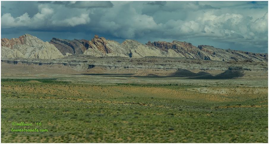
Leaving Moab, we headed west and were soon enough on Hwy 24, a designated scenic byway. Steve tried to focus on driving while craning his neck as we passed stunning views. Enormous exotic rock formations in shades of gray and maroon loomed out of the landscape all around us, as we cruised through a vast and colorful diverse landscape. Here are a few of the photos I snapped through Betsy’s windshield as we moved along:


We were captivated by pale towering cliffs, rounded domes and jagged red rock outcroppings as we drove through Capitol Reef National Park on our way to our next home base west of the park’s visitor center.

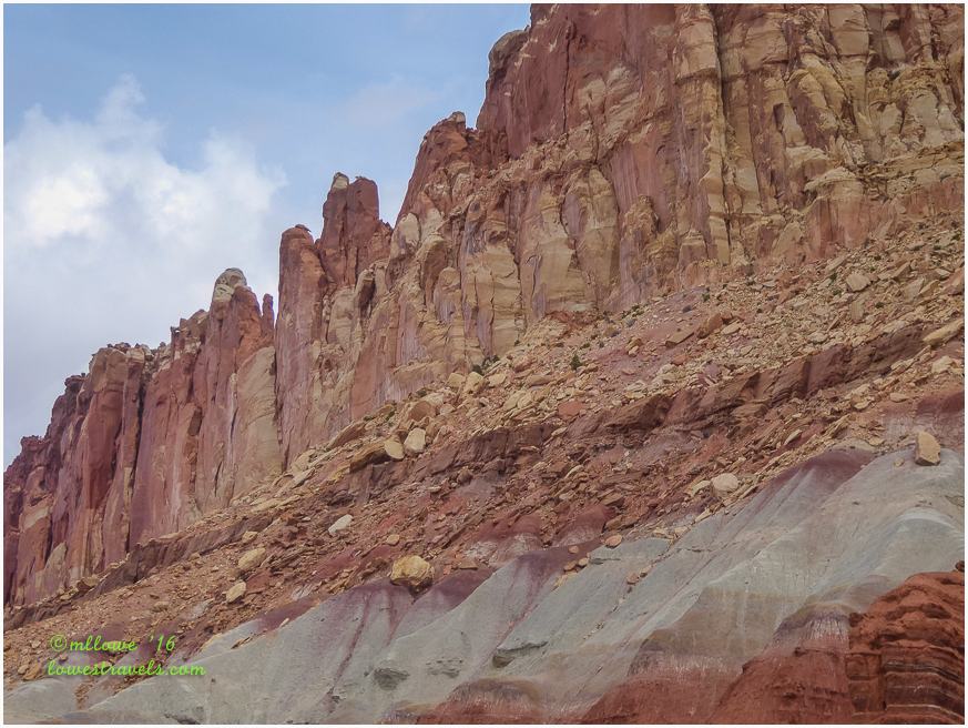
So why is it called Capitol Reef? Well, it appears the early pioneers provided the park’s namesake – “capitol” for the white domes of Navajo Sandstone that resemble the capitol dome in Washington D.C., and “reef” for the rocky cliffs that are a barrier to travel, like an ocean reef.


Geologists call the sheer unbroken rock here a Waterpocket Fold. The uplift contains numerous small bowl-like depressions that hold rainwater, and this fold stretches for a hundred miles north to south. Driving from the east we could see the high stone barrier that appeared to rise like the swell of giant waves rolling toward a shoreline.
The section of Hwy 24 we followed was the only paved road that crosses the Waterpocket Fold.

This park is amazing and unique in its own right, and holds its own against sister parks Zion, Arches, Bryce and Canyonlands. We learned that Capitol Reef NP is home to the largest historic orchards in the national parks system – huge holdings with 3,000 fruit trees.
Had we arrived at harvest time, we could have picked and eaten the freshest of fruits. But on this stop I was happy to settle for the tasty homemade pies sold at the Gifford House within the park.


Mormon settlers came here in the 1880’s and established orchards of apples, peaches and pears at the confluence of the Fremont River and Sulphur Creek. They flourished in the tiny town that came to be named Fruita. Today the town is long gone, but some families remain and the extensive lush orchards thrive along the river.

The first order of the day was to take the scenic drive running along the Waterpocket Fold all the way to the Capitol Gorge spur. We stopped at the visitor center to pick up a guide to sights along the route, and that’s where the drive began. Being in southern Utah for two months now, we continue to be blown away by the amazing landscape.

The Waterpocket Fold is the major geologic feature that defines the park

Most rock at Capitol Reef is sedimentary, formed in layers of differing thickness, colors, and textures that lay one upon another like layers of a cake. These rocks were laid down in many different environments during the past. Younger rocks lie on top of older rocks.

Uranium was also mined here a long time ago.


The Capitol Gorge spur road was the only way through the park between 1884-1962. It took mormon pioneers eight days to clear the first road through the Gorge in 1884. It was closed in 1962 when Utah Hwy 24 where we came in was paved through the Fremont River corridor.


Since this is not a loop road we drove back the way we came and the views were just as stunning in the reverse direction. The amazing colors, textures and sheer size of the formations along this drive kept us muttering, “Wow!”
As we re-entered Fruita the wildlife was very active:


While stopped at the Gifford Farm we saw the horses playing around. This was the first time I witnessed two horses kissing.


The oohing and aahing has just begun as our the explorations here continue!
Comments
8 responses to “This Place Rocks! Capitol Reef National Park – UT”
US 24 was an amazing ride, we needed a bit more time at Capitol Reef, still a few areas we’d like to hike. Really enjoyed those pies after a long day of hiking. Thanks for a wonderful tour.
Beautiful travel day pictures MonaLiza. Can’t wait to visit Capitol Reef one day…
How I love Capitol Reef, tge campground, the pies, the hikes. Your pictures are fabulous. They make me want to be there right now!
Your “drive by” photos are just gorgeous! We love that area, too. It’s fun to camp in the Fruita campground during harvest season. We stayed there a few years ago in the fall and picked apples—I made an apple crisp to share with our neighbors. Definitely time for a revisit for us. Thanks for reminding me. 🙂
Absolutely beautiful, MonaLiza!
Such a wonderful hidden gem. I sure hope too many more people don’t find out about this NP. It is still nice to have a gorgeous place without thousands of people. Your photos are spectacular! Thanks for taking back:) Love that last photo of the horses:)
I know I can’t wait to spend more time in southern Utah. The landscape is stunning. Thanks for a wonderful tour…. yet again 🙂
These are wonderful photos MonaLiza, its almost as if we were riding along in Betsy with you! Thanks for sharing that beautiful route, we’ve not driven it ourselves yet so its certainly on my list now!