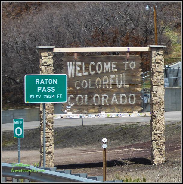
From the southwestern high-desert we climbed into the mountains of Colorado, the 40th state visited on our adventure! It’s interesting that as soon as we entered Colorado we could tell we were in a new and different place. Leaving the wide open skies and dusty deserts of New Mexico, it was exciting to be moving into the green mountains of Colorado.
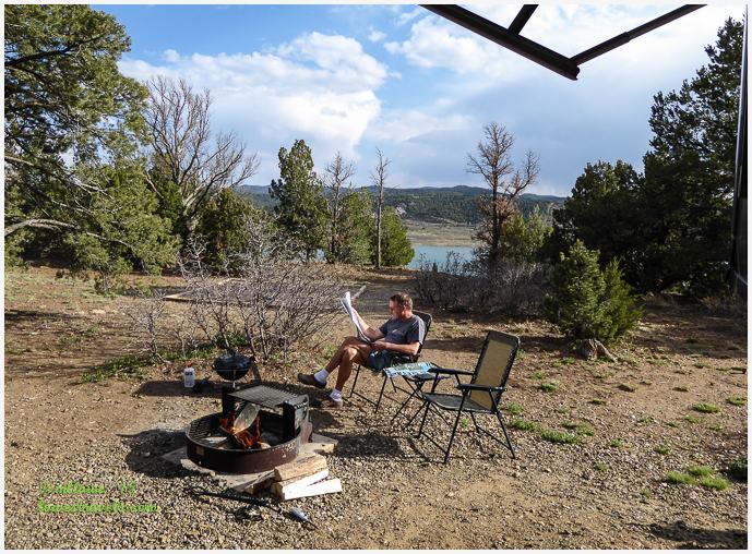
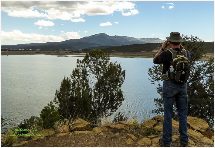
Our first stop in the Centennial State was at Trinidad State Park (Steve’s review here). It is nestled in the southern Colorado foothills of the Culebra Range of the Sangre De Cristo Mountains. We were happy to be surrounded by Pinon-Juniper forests and breathing fresh mountain air after so many months in the open desert. The wonderful mountain views also made us feel like we were really back in the west again. This was confirmed when Steve yelled in excitement upon seeing the first Safeway grocery store in three years!
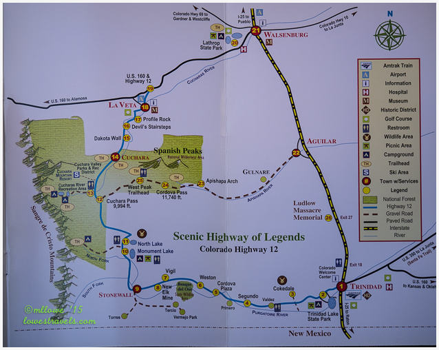
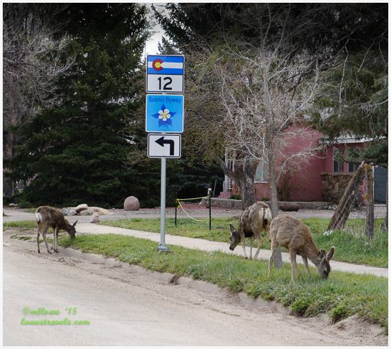
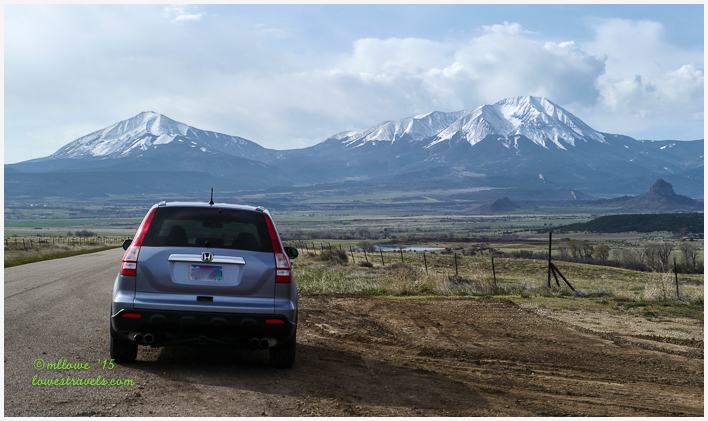
Our stay here was a bit short, so our first excursion was an-all day driving trip to explore the scenic Highway of Legends. This beautiful area is bordered by Colorado Highway 12, and sections of U.S. Highway 160 and I-25. The highways encircle the two majestic peaks of Southern Colorado known as the Spanish Peaks. The land in the area was held sacred by American Indians, and the Spanish Peaks themselves were thought to be the abode of the Gods. The lore of the area spawned the name for the very scenic HW-12, the Highway of Legends.
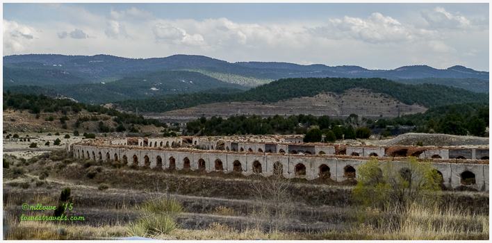
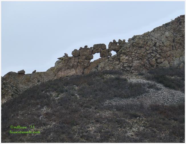
The beautiful mountainous drive began right outside the Trinidad State Park entry gate, where we headed west and then north. Just a few minutes into our drive we noticed something that looked like a scene from the Roman Empire. We discovered that the arching alcoves seen from the highway are actually the remnants of what were coke ovens used to produce smelting coal from the nearby mines in Cokedale.
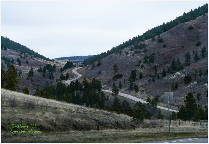
We meandered through small mining and ranching towns, then into the San Isabel National Forest, crossing the 9,994 foot Cuchara Pass. The almost empty 2-lane highway wound around gorgeous lakes and valleys, unique geological formations and historic features. Each point of interest had a myriad of legends from the Native Americans, Spanish Conquistadors, pioneers and traders.
I took tons of pictures, as you might imagine. But what is unimaginable is what happened later – after a long and tiring day I accidentally deleted ALL the pictures from this trip on my point and shoot camera! The horror! Sigh 🙁
To say I was upset with myself is an understatement, partly because all of the shots with me in them were gone! But the blogging must go on. The upside is that I had far fewer pictures to wade through – only the ones on my DSLR camera – which were unfortunately mostly wide-angle shots and not my favorite close-ups. Darn!!!
One of the most striking features along the Highway of Legends is the widespread presence of long rock “dikes” sticking out of the mountains like fortress walls. We first saw these formations at Big Bend National Park, but here their height and length are spectacular. Our first encounter with these geologic walls was at mile marker 37.8, near the appropriately-named town of Stonewall.
These large rock walls that rose to 250 ft. above ground are part of the Dakota Sandstone Formation created millions of years ago. This is the point where I wish I had the images of the Dakota Wall, as it was very impressive. We continued our drive and encountered a prime example of the 400-plus stone dikes that radiate out from the Spanish Peaks, called the Devil’s Stairsteps.
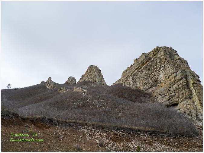
The dikes are evidence of southern Colorado’s volcanic past and run outward like spokes from the Spanish Peaks. They continue above and below ground for as far as 25 miles. The dikes were created by the squeezing of molten rock into softer rock layers. When these layers eroded, the harder rock was left standing like walls. Many are more than 100 ft. high and they run all along the Highway of Legends from Stonewall to La Veta.


We turned west once again onto highway 160 and headed toward the Great Sand Dunes. Did I mention this was to be an all-day trip? Besides, we had to make use of the Annual National Park Pass we had recently purchased.
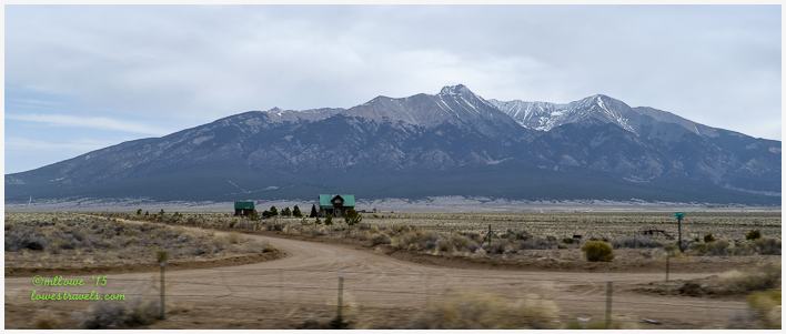
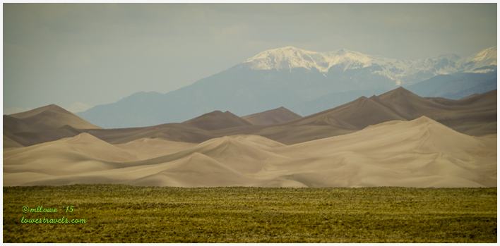
More breathtaking scenery awaited us on the way to the dunes. Mount Blanca, the fifth-highest of Colorado’s fifty three 14,000 ft.-plus summits (known as the 14ers), stood majestically before us at 14,351 ft.
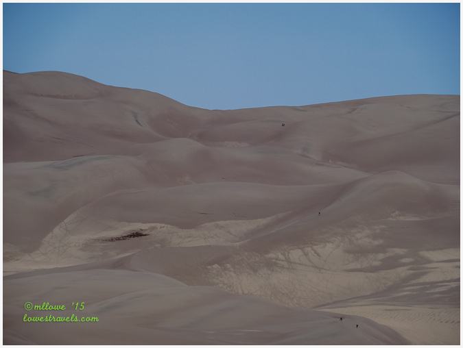
The Great Sand Dunes are North America’s tallest dunes, and they rest against the rugged Sangre de Cristo Mountains. A new LiDAR mapping tool use by the park shows that the dunes contain about 6.5 billion cubic meters of sand (give or take a few grains).
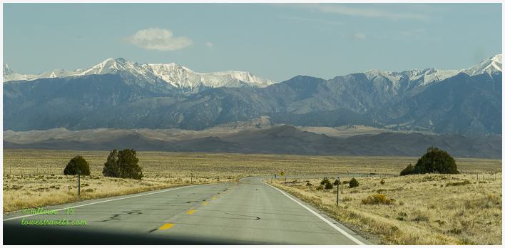
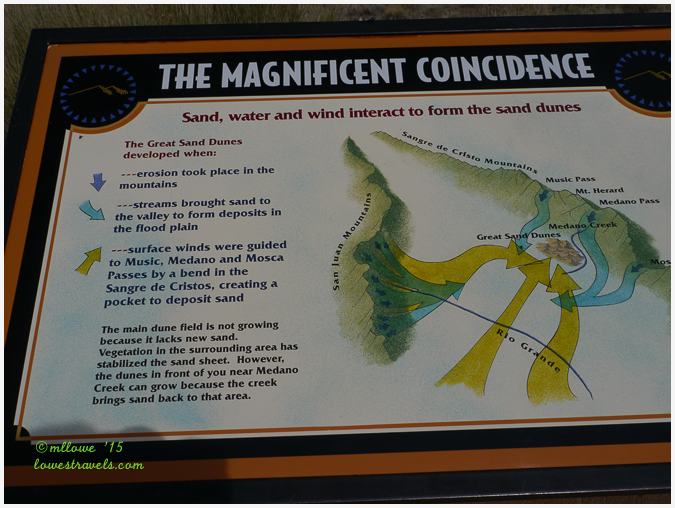
The main dune field is a massive 30 sq. miles, and mapping shows there are five dunes over 700 ft. tall with the Star Dunes being the tallest at 755 ft.
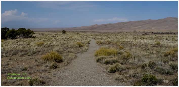
After following the nature trail and learning about the dunes we were excited about hiking up High Dunes, which was only 2.5 miles roundtrip. Unfortunately, we didn’t realize that Medano Creek, which flows in front of the dunes’ only access, was flowing quite high. Since we weren’t equipped to cross the water in addition to making the hike (and it was getting a bit late after our 120-mile drive), we decided to skip this one.
Instead we hiked the shorter Montville Trail and another one that lead to the campground. We enjoyed great views of the dunes from across the valley, but of course those were lost with many others in my photographic blunder.
If you want to read a good first-hand account of what it’s like to hike the Big Dune, check out David and Sherry of In the Direction of Our Dreams to learn of their experience.

On our way back home we saw lots of storm clouds ahead, and some lightning strikes near our destination. Happily, the result after a long day of driving and exploring was just some much-needed rain and a free rinse for Betsy.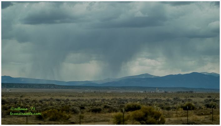
In one day we had seen several of Colorado’s scenic and spectacular mountains, along with a lot of unique geology. And to think we’ve covered only a part of the state’s southwestern area!
Colorado is already starting to grow on us…
Comments
17 responses to “Our first peek at Colorado’s peaks – Trinidad, CO”
You just might have answered the question of where to stay before we arrive in Colorado Springs in early June. Now to go see if they have sites available for our dates.
Those Spanish Peaks are really beautiful. No wonder the Native Peoples considered them Sacred. Thanks so much for the shout out. We really loved our stay in the campground at Great Sand Dunes and enjoyed our hike up the dune once the sun finally came out. But I can’t even imagine Medano Creek being so high you couldn’t cross it. We read about people tubing it but it wasn’t even there at all in the fall when we hiked the dune. Great pictures! Thanks for taking us back.
Oh no!! I’m so sorry to hear of your photo mishap — I have the fear that I’m going to do that same thing one of these days. (Maybe it would be a blessing because I have hundreds of Eric’s photos to sort through every day along with my own.) Your landscape shots are absolutely beautiful — that header is amazing, along with the Spanish Peaks and the Devil’s Stairsteps. We’re looking forward to exploring more of Colorado in the next couple of years.
Oh, no. I am so sorry. The feeling that comes after such an action is terrible. If you aren’t backing photos up on the cloud, or on a hard drive already, you need to. I had this same experience once, and lost a year’s worth of photos. Now I dump photos on my laptop daily from my camera and back them up online and on two external hard drives.
So sorry to read about your “little” mistake. You’ll just have to redo the visit one day:) You still have many gorgeous photos. It was probably an omen that you couldn’t hike out through the dunes. Hiking in deep sand does nothing for me. The dunes are beautiful from afar:) I love the stone dikes! I’ve never seen anything like this. So glad you found this unique formation and shared your new knowledge. We’ll have to check it out some day. You know me and my rocks!!! Steve looks mightly comfortable sitting there in the gorgeous mountain scenery:)
John said to make sure I told you he really enjoyed your header:) I agree…it is so beautiful.
Thank you John. I almost had a heart attack when I realized what I just did. I think so too, glad the water on that creek was a little high or I would still be there trying to pull myself off the sand.
I love Colorful Colorado and I have only seen a very small sampling. I enjoyed riding along with you. You covered a lot of miles in one day! So sorry about your pictures…I did that once too!
We loved our stay at Trinidad Lake SP and driving the Highway of Legends. Absolutely fell in love with Cuchara after stopping for lunch there and would love to go back sometime. So sorry about losing your pictures, though. Know that must be such a disappointment.
I can imagine your frustration when you realized you’d deleted your photos! I’ve done that once and hopefully never again…gotta maintain a system and keep from getting distracted during the process!
Reading this post I am so excited to get into CO! Of course we are staying at Trinidad SP (since we almost always stay at the same parks 🙂 Looks like we’ve got some weather on the way…
You sure did see a lot in one day! I hate that you lost some of your pictures but the ones you have are beautiful. I love the Spanish Peaks photos!
How devastating to accidentally delete your photos! I think I would have cried. Colorado has some really magnificent scenery, Mona Liza. You got some great images to show us. 🙂
So glad you are exploring Colorado. We LOOOOOOVE Colorado! Sorry ’bout the pics.
I deleted pictures from our trip to Giza in Eygpt. I used a program from wondershare I believe to retrieve them.
Wow, I can’t believe how much you did in one day. That is some beautiful scenery that I of course am very familiar with. I could see the Spanish Peaks from the deck of my previous home. Almost everyday in the late afternoon storms would roll in and we’d watch the most amazing lightening storms. The Sand Dunes are pretty this time of year when there’s still snow on the mountains. So sad to hear of the lost photos…. bummer 🙁 Have a wonderful trip to the Philippines 🙂
We LOVE Colorado! Your pictures are absolutely fabulous….but sad about the lost photos. I did that once….irreplaceable!
Enjoy Colorado for us. Not sure when we’ll get back there.
Colorado continues to be one of our favorite states. So sorry to hear of your lost photos. I have not done that but we did have a computer crash a few years back and lost many photos. I’m sure you will find many more beautiful photos to take during your time in Colorado.
I’m upset for you about your lost photos. You’ve still got some great ones. Love the dunes!