Our next adventure took us to the coastal wilderness where we experienced yet another Bay of Fundy phenomenon – a coastline sculpted by the worlds highest tides. It was a long and scenic drive to the Fundy Trail Parkway, and a bit foggy when we arrived. So, you may wonder, what is the Bay of Fundy and what’s the big deal?
The Bay of Fundy is a bay between the Canadian provinces of New Brunswick and Nova Scotia. The bay is known for having the highest tidal range in the world because it is funnel-shaped across its width, deep at one end and shallow at the other. This configuration forces tides to be pushed higher as they move up into the Bay. We were fascinated to learn that the highest tides on earth fill the bay with over one hundred billion tons of seawater – as high as a four-story building – and brimming with diverse marine life. Just hours later at low tide, we were able to stroll among the rock formations on the seabed.

There are three interesting ways to observe the tides: the Vertical Effect, the Horizontal Effect and the Tidal Rapids. In my previous post, the Reversing Rapids were an example of Tidal Rapids. During our exploration at the Fundy Trail Parkway we saw an example of a vertical tide.
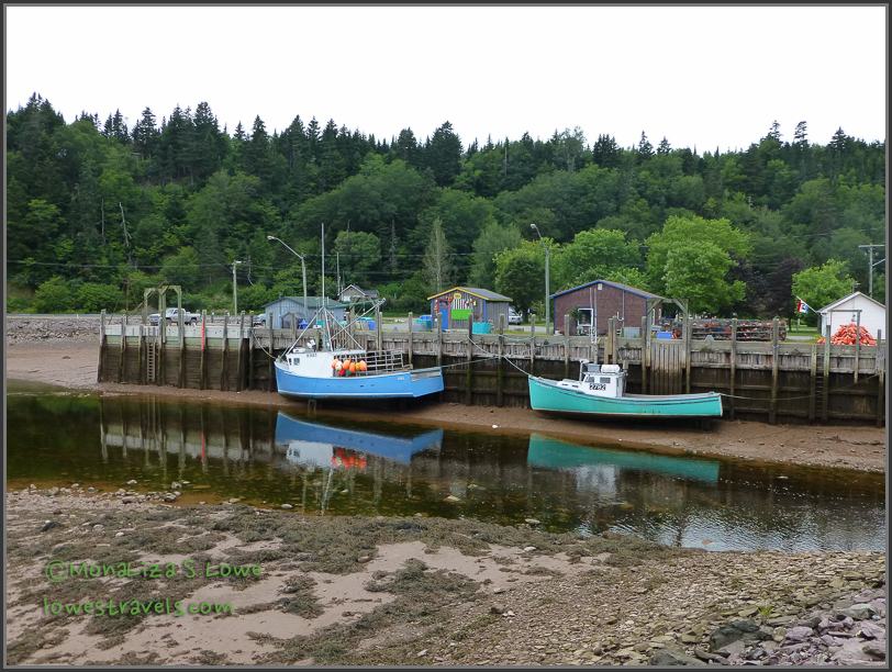
At St. Martins, gateway to the Fundy Trail Parkway, we spotted a small harbor where fishing boats were sitting on the ground during low tide. On our way back home we saw the boats bobbing in the water alongside the wharf. Small harbors are the best place to see vertical tide changes that can be 50 ft or more!


We stopped at many lookouts to view towering cliffs, undeveloped coastline and panoramic vistas of beaches. The Fundy Trail winds its way along one of the last remaining coastal wilderness areas between Florida and Labrador.


At one point we hiked down to follow the Fundy Footpath all the way to Fundy Point. We skirted along Big Salmon river and hugged the coastline, where Steve decided to create his own path all the way to where the river flows to the ocean. He thought we would then walk across the shallow beach there and walk back up the path on the other side. Wrong!
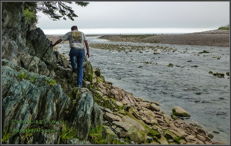
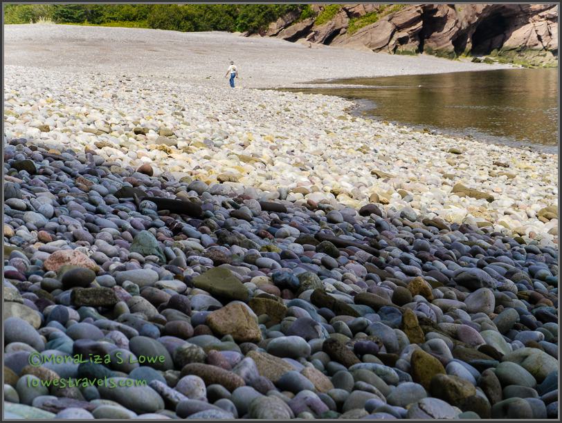
When we arrived on the beach, we witnessed horizontal tide, which happens when the low tide retreats as much as three miles, leaving vast areas of the ocean floor exposed.
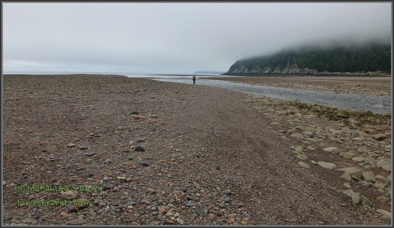
Unfortunately we were just a little late and the tide was coming back in, so we had to double back on the trail we had just taken. Oh well, nice try!
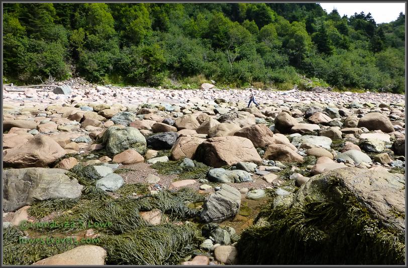
On the ocean floor, we took notice of the seaweed attached to rocks, and tiny black sea shells…


…also some beautiful wildflowers and critters along the “real” pathway as we returned…


…finally arriving at the suspension foot bridge – the easy and correct way to cross Big Salmon river.

With the fog lifting by early afternoon, we chose to follow the path to the Fuller Falls lookout, then hiked just over a mile down to Melvin Beach. We noted the clay colored cliffs and colorful sandy stones that we walked on. The tide was starting back in so we chose to stay at Melvin Beach and not cross over to Pangburn Beach.


The entry fee was worth every penny, for we thoroughly enjoyed each view, path and trail we followed. The 10-mile Fundy Trail Parkway is well constructed and maintained within the most picturesque area of the Bay of Fundy, and it provided us with a variety of experiences along its length.


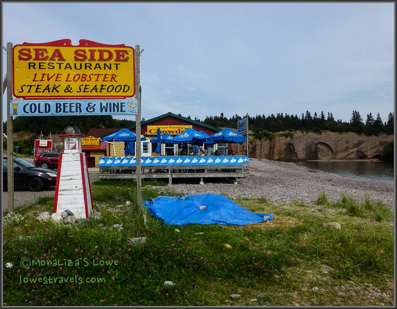
On our way home we stopped by St. Martins village and enjoyed some more local fresh and delicious seafood, this time a lobster roll and a cup of delicious chowder. The restaurant had a great view of beautiful sea caves – shallow features carved into sandstone and conglomerate caused by physical erosion of the high and low tides.


More images captured on our way back to camp…

A colorful home with a matching colored barn and gift shop


And back to the curvy and steep grades along scenic highway 111 .

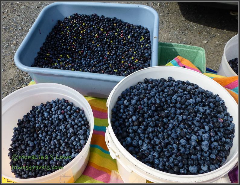
We stopped and bought wild Canadian blueberries, with which I baked a delicious pie that we savored after a long day of exploration.
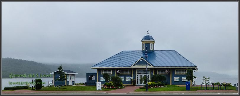
We never fail to admire the Grand Bay-Westfield visitor center as we passed by it on our way in and out of the campground.
We have more stories and pictures to share – the Canadian Maritimes are so scenic and colorful. The weather has been near perfect, sunny but a bit breezy at times. Stay tuned!
Comments
17 responses to “Exploring Fundy Trail Parkway- St Martins, NB”
The Bay of Fundy is truly amazing and you have really captured its allure. Chuck’s favorite of the provinces was PEI. Mine is Nova Scotia – I see you are going there too. I’m seeing all those LOBSTER signs and the stomach is rumbling….Baked a blueberry cobbler the other day too Yummy.
My goodness, it is always a lobster feast in our house.
We are going to love your travels through Canada as we know virtually nothing about this area. It looks like a fascinating place to explore. Your photos are so lovely Mona. Are you still using the Panasonic camera? I have been researching cameras and would love some feedback on what you think about the camera you are using.
My favorite photo is you on the suspension bridge. You look like you are having a blast! 🙂
This is actually my second Panasonic Lumix DMZ-ZS19 as I dropped the same model in Philippines. I use this camera 90% of the time and the other time i used my Panasonic Lumix GH2. Love this cam as the image quality is really great a you can see in my shots.
Awesome! The smile on your face tells it all! We’re you surprised that the sand during low tide was not very squishy? We were. Totally loved the rocks and caves…so cool!
So glad the weather is perfect and you are making wonderful memories!
Yum….a blueberry pie!
So far the weather has been on our side. I m glad our photos brought back lots of good memories out here.
So glad you got to witness the dramatic tide change. It is so amazing! Looks like you are having a wonderful time with great weather. Love the picture on the swinging bridge:)
Yes we are having a blast!
Vertical tide and horizontal tide. I’ve seen them but never knew they were called that. I always learn something when I read your posts. Great photos as well. Interesting to see high and low tide pics. And I always love a map!
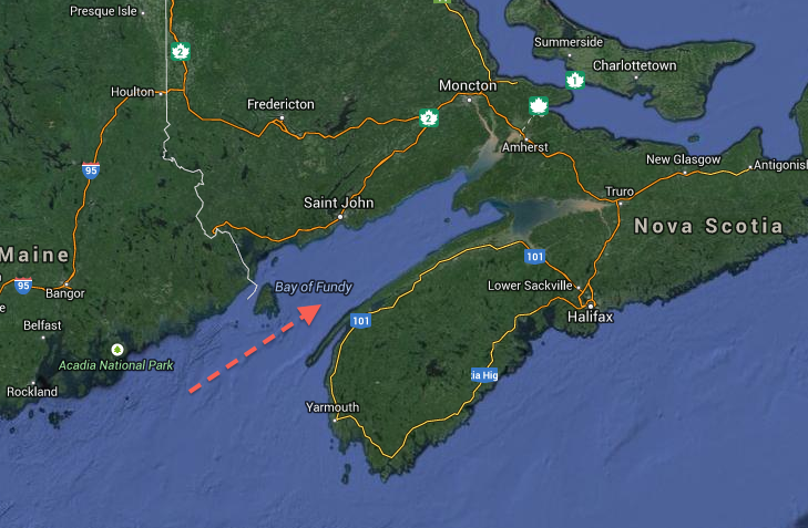
Thanks and I think more maps are in order so my readers dont have to look at google to check where we are at.
Great idea!
Love the beach! All those cool rocks just waiting for us! Love the low low tide, cool how you can walk so far out!
After your AK adventure you might just want to spend your summer here next year.
Awesome photos and story! I’m glad the tide did not suck you out to sea.
Keith Jackson is the guy with the red hair and the black hat in my photos on Facebook. His living wake was really fun. What a brave guy to throw his own wake.
Have fun in Canada!
I know, he is truly brave not sure if i can be in my own wake.
Love your new header photo. Looks like you’re having way too much fun, if that’s possible. How bizarre to see those boats at low tide sitting dry then later floating like they were meant to. Interesting to say the least. Enjoyed the house photos as well….ya know me and Real Estate 😉
I would venture to say, that you will love it here. Pretty, Picturesque and just different.