Steve is smiling for he can now check one off from his bucket list, the Columbia River Gorge. The Columbia River Gorge is an impressive river canyon carved by the Columbia river as it flows into the Pacific Ocean. It stretches over 80 miles and is shared by the states of Washington and Oregon. Mt Adams to the north and Mt Hood to the south flank the gorge and the mighty Columbia River runs through its middle. The bridges that connects the states are: The Dalles to the east, the Hood River in the middle and the Bridge of the Gods to the west. The Gorge is recognized as a destination for exploring the natural beauty and cultural richness of the Pacific Northwest. Geologists must love this place with all its cliffs, rock formations and rugged terrain.

We spent a whole week exploring and enjoying the gorgeousness while staying at White Salmon on the WA side as our base camp. During our stay, we weaved in and out of Washington and Oregon through their $1.00 toll bridges and drove from east to west by taking highway 14 on the Washington shore and 84 on the Oregon side. We had an action-packed week and we loved it despite some hazy and smoky days.
What did we learn and enjoy? Plenty ! and so we will have more than one post to talk about the gorgeous gorge.
Lets start with the waterfalls. Oregon has 77 waterfalls and the Gorge contains the greatest concentration of waterfalls in North America. These spectacular waterfalls are all within approximately a 15-mile stretch! Traveling along the Historic Columbia River Highway 30 on the Oregon side of the Gorge, we were able to view five different waterfalls cascading over the walls of the Gorge.
Our trek began at the Latourell Falls which is usually the first waterfall seen along the Columbia Gorge Scenic Highway if coming from the west. The falls plunge 224 feet over a massive wall of columnar basalt – some of the best formations in the Pacific Northwest – before cascading hastily towards the Columbia River.
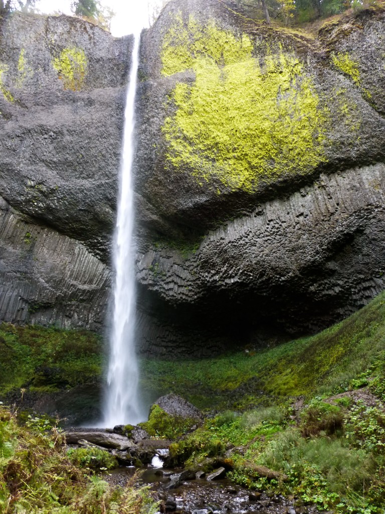
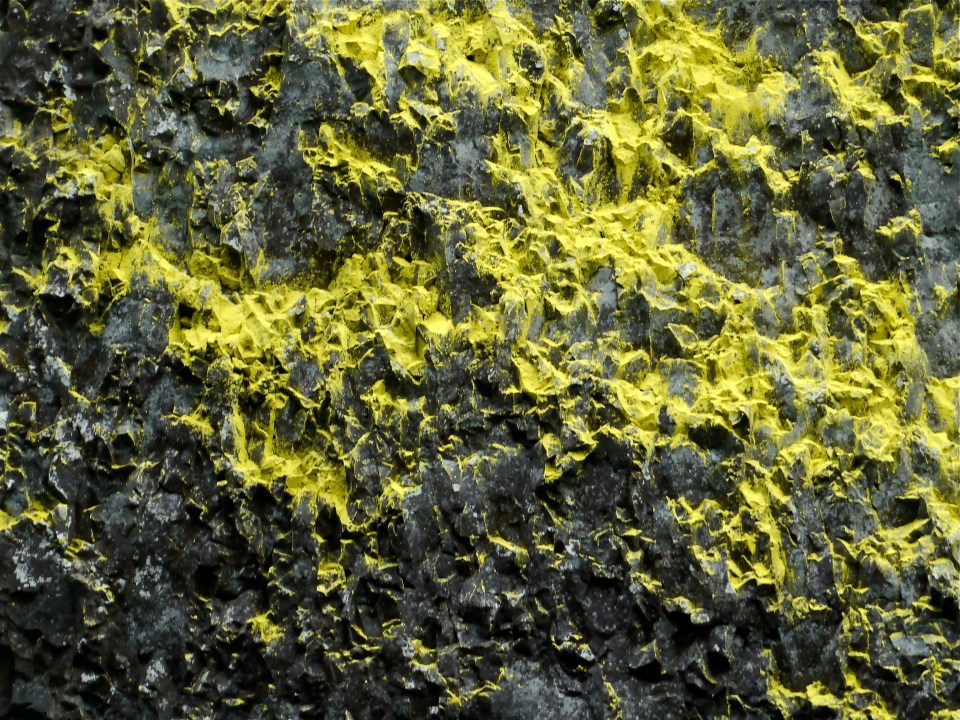
What was distinctive to this fall is the large patch of bright yellow lichen adorning the cliff face to the right of the falls, and maybe because of this we saw several photographers in the area.

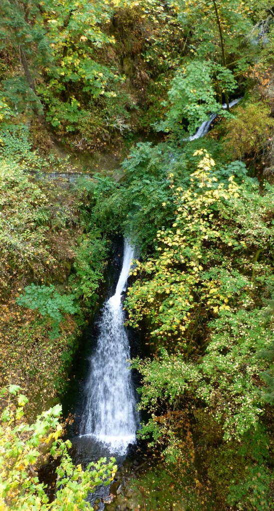
Next stop was the Shepperds’ Dell Falls. Though looking straight down from the bridge will allow one to see the two final drops, only the 45 foot tier and a pair of the small cascades above it are clearly visible.
3.5 miles later we park our car and hiked for about 2.2 miles roundtrip to get to the base of the Bridal Veil falls, considered as the most pristine among the waterfalls in the area. This two tiered falls are the only in the area which occurs below the historic Columbia Gorge Scenic Highway – the base of the falls standing probably no more than 20 vertical feet above the Columbia River.

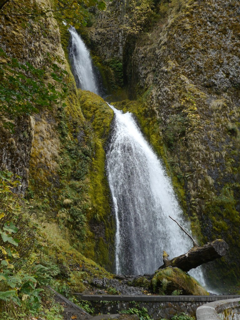
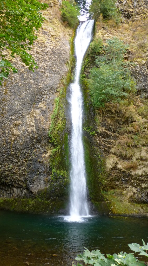
Continuing on the drive the next stop was Wahkeena falls. At 242 feet, it can be seen from the Wahkeena picnic area across the Historic Highway and is the most scenic waterfall along the historic Columbia Gorge Scenic Highway. It is unique among the major waterfalls in this section of the Gorge in that it possesses a significant alluvial fan in both size and elevation.
Then about half a mile later is where the most visited natural attraction in Oregon is located, the Multnomah Falls. It is the highest waterfall in the Columbia River Gorge with a total drop of 620 feet. We did a 2.5 mile hike up to the top of the falls with 11 switchbacks and a 650 foot elevation gain. Although the top was not as spectacular as we expected, the hike was a good workout.


Our final viewing of waterfalls along the historic highway was the Horsetail Falls. This one is considered pretty much the epitome of the Horsetail form with views from 180 degrees around the falls.
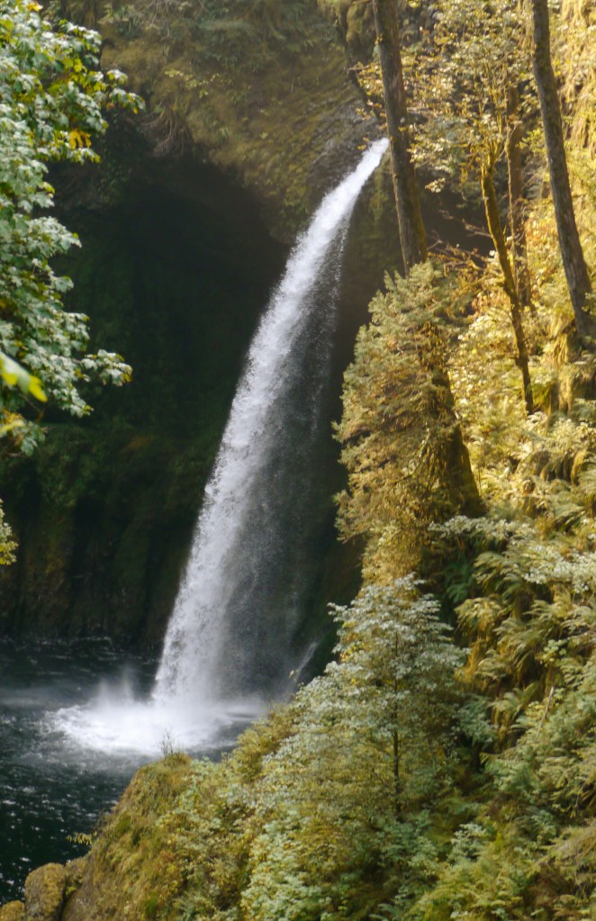
The above beauties were all accessible from the highway, two other waterfalls that we located and viewed required quite a hike. Both Metlako Falls and Punchbowl are located along the Eagle Creek trail in the Columbia River Gorge National Scenic area. Metlako Falls drop out of a narrow, calm pool, and thunder into an impressive gorge.
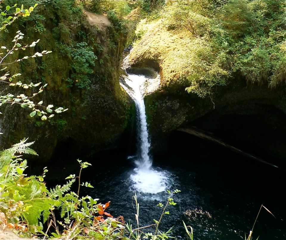
The Punch Bowl falls occur where Eagle Creek cuts through a narrow channel flanked by cliffs, and shoots powerfully into a large bowl. The falls’ name is a very descriptive one, as it’s easy to see it’s resemblance to an actual bowl you’d pour punch into.
And we viewed what we can in one long day, but did we see them all ? Nope, we missed two along the historic highway Oneonta and Elowah Falls (not sure why we overlooked them). Are they not all beautiful?
Comments
11 responses to “Waterfall Heaven – Columbia River Gorge, Part 1”
Those photos are unbelievable! Makes the midwest’s waterfalls look like wannabes! We’ll get out that way when we retire early…but that’s not for another 8 years, unfortunately. In the meantime I guess we’ll just live vicariously through great blog posts like this one!
Thanks glad you are enjoying them as much as we did even just in pictures.
As usual, awesome pictures.
Beautiful!!! Was wondering what you were up to 😉 and I see that the Pacific Northwest has captured you!!!
Ha ha, we have to make sure Steve’s bucket list is taken cared of.
Beautiful, beautiful photography!! You’re walking in our footsteps and I’m enjoying every post more than I can tell you. I wish we could do it again and again and…….
Can’t wait for more! Enjoy!
Oh thank you. this place is huge and realized cant do or see it all.
Beautiful pictures of the falls. I didn’t realize there were so many of them when we traveled through there. And what? No more pictures of moose? 😉 Welcome back to the lower 48. Can’t wait to hear where you go next. Keep safe. Hugs…
Thanks Sue, there were actually two more we missed. Sorry no more Moose this time.
Wow….beautiful. That was a lot to take in in one day! Look forward to hearing about the rest of the adventure 🙂
Thanks, that is why we missed two bec we thought we were done.