
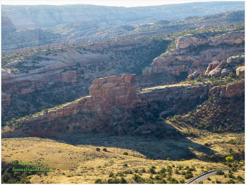
The Rim Rock Drive at Colorado National Monument was a convenient way to admire the iconic red sandstone landmarks there, and to peer into the gaping canyons. (Read post here) After doing that for a few hours it was time to lace up our boots and hit the trails. There was a large assortment of them, plus an additional list of trails outside the monument provided by Pam (Oh the Places). It was hard to pick which ones to follow, but we certainly weren’t disappointed with our choices.
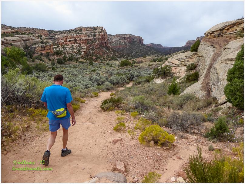
Devils Kitchen Trail
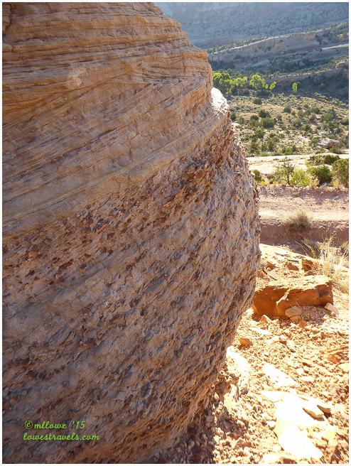
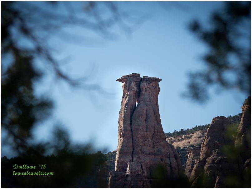
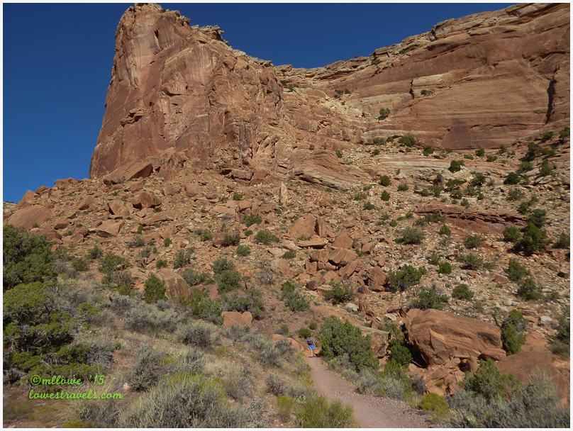
Going down into the canyons and looking up at the massive walls gave us an excellent new perspective of this place. Among so many formations, we didn’t take much notice of a particular one during our drive at the eastern end of Rim Rock Drive, which we later learned was called the Devils Kitchen.
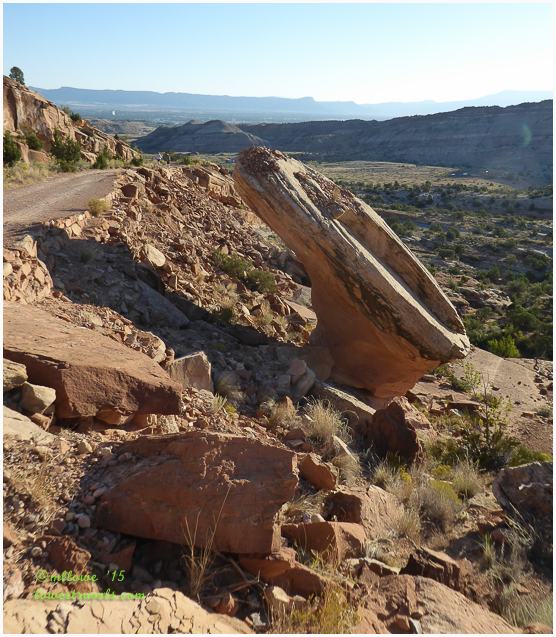
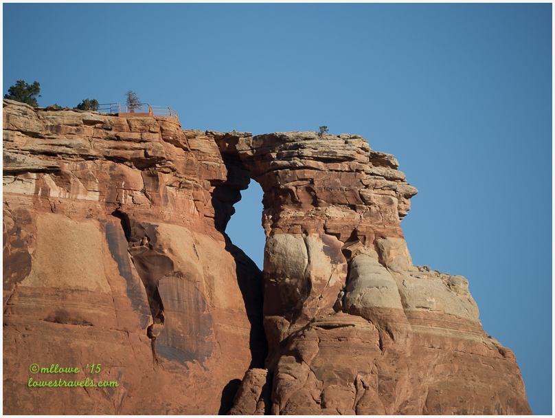
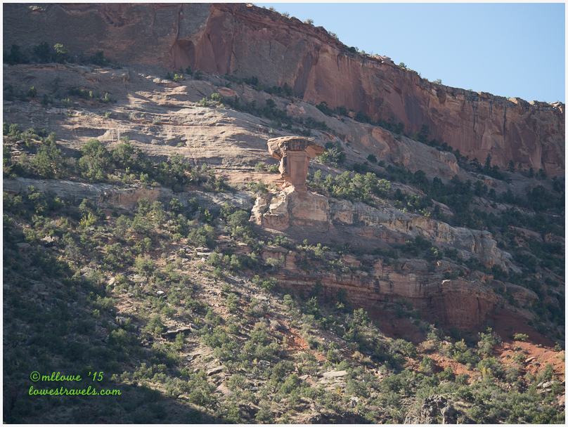
Devils Kitchen is a natural rock room surrounded by Wingate Sandstone formations that provide a lovely resting spot after a fairly steep ascent. In past excursions we’ve seen our share of devilish places – Devils Lake, Devils Den, Devils Hole, Kill Devil Hill, Devils Bathtub and Devils Playground. But I didn’t know a devil could cook, and this short moderately-difficult trail was the way for us to investigate.

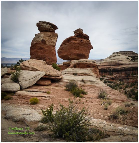


The sandy trail was lit up with these colorful wildflowers:


Serpents Trail
This is the most popular hike at the monument, and we had plenty of company on the sunny day we took it. Long before it became a hiking trail, this was an old dirt road once dubbed “the crookedest road in the world.” The only road through Colorado National Monument at the time, its construction began in 1912 and was guided by John Otto.
Completed in 1921, the road encompassed 50 switchback turns and was very steep. In fact, it was so steep that cars had to back up many sections of the road because they didn’t have fuel pumps at the time and relied on gravity to get fuel to the engine. That must have been an exciting drive!
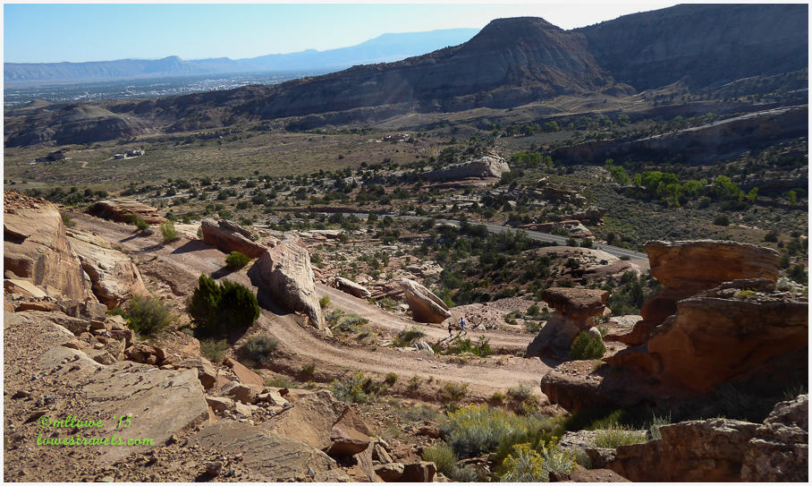
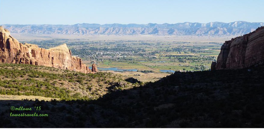
By 1950 the old road was closed and converted to a hiking trail. It curves back and forth through Wingate Sandstone for 1.75 miles one way, gaining 770 feet of elevation along the way. At one lookout we could see its replacement, Rim Rock Drive, on the east side of the hill.

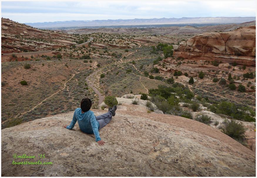
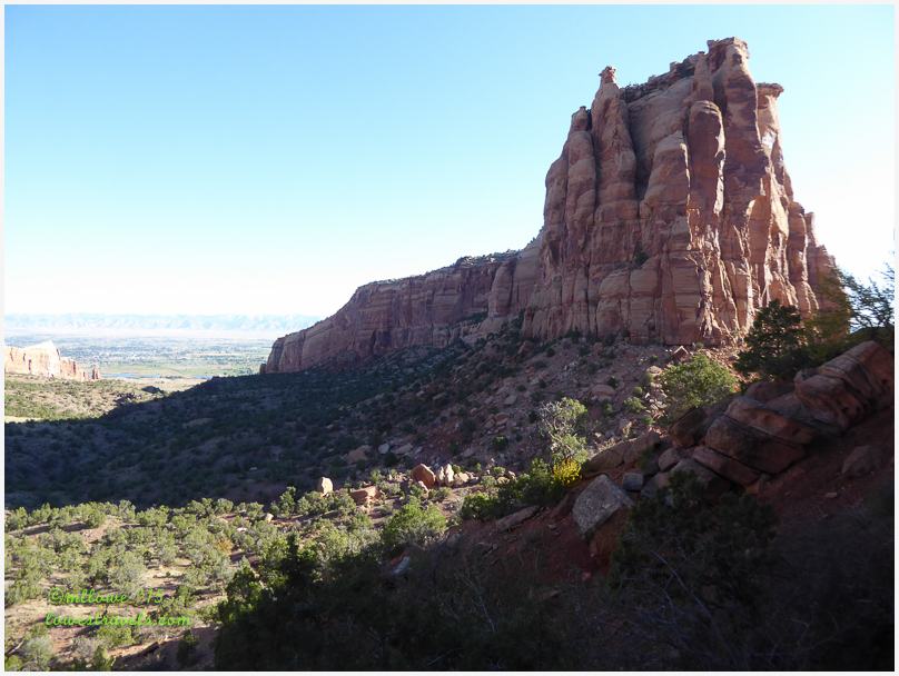
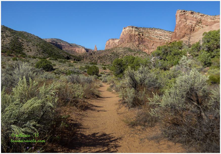
Wedding Canyon Trail/Monument Canyon Trail
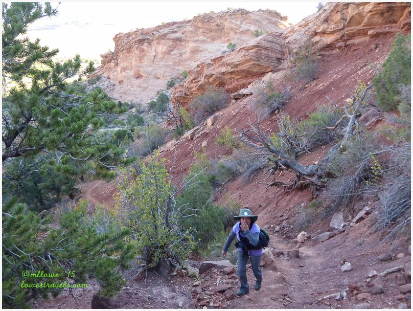
The Wedding Canyon and Monument Canyon trails both travel 2.5 miles one-way to the base of Independence Monument. On this hike we did what Pam suggested, going out to the monument via the Wedding Canyon Trail and then looping back and returning on the Monument Canyon Trail. The Wedding Canyon Trail follows the national monument boundary for awhile, and we noticed some of Fruita’s high-dollar homes just on the other side of the fence. These folks even have their own rock formations in their back yards!

The trail makes a turn to the southwest and begins its gradual ascent into Wedding Canyon. We were surrounded on either side by massive sandstone cliffs as we kept our eyes peeled for the Bighorn Sheep that roam the ledges around the canyon. No sightings on this day – maybe next time we should tag along with John and Pam, who seemed to be magnets for these creatures.


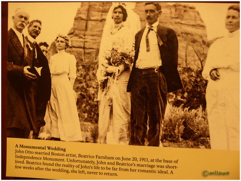
Wedding Canyon was so named because of its location where John Otto had his wedding. The folks in the photo below don’t look very happy, and in fact the marriage lasted only a few weeks before John’s wife took off, never to return.
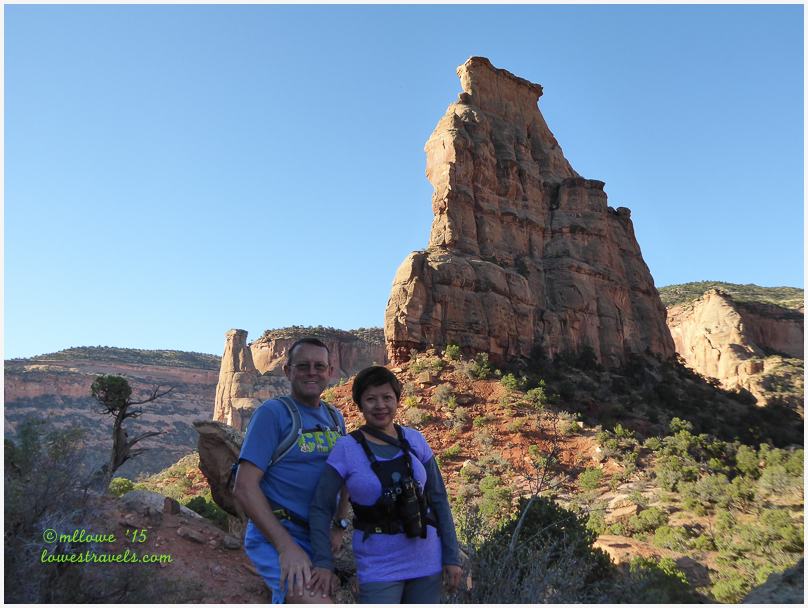
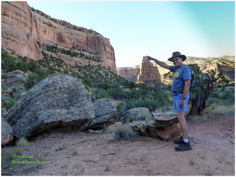
Two and a half miles from the trailhead we reached a major trail junction and the base of 450-foot Independence Monument. Four trails from each compass direction come together here. We climbed about a hundred feet up the base of Independence Monument just so we could say we touched it, then continued north on Monument Canyon Trail.


As we headed north on Monument Canyon Trail we saw…
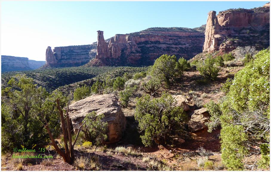

Looking back from the trail, Independence Monument looked so small from a couples miles away. The ups and downs of the trail gave us a good workout and we enjoyed the closeup views of so many sandstone formations and gigantic red canyons. Not being able to hike more of these trails gives us an excellent excuse to come back to check them out, and to enjoy the environment of one of our favorite towns so far – Fruita.
Comments
10 responses to “Hiking Colorado National Monument – Fruita, CO”
Fruita does sound intriguing. There certainly is lots of beauty in the area. We will have to put this one on our list.
The hiking in the monument looks fantastic! It’s definitely a place we want to visit. And I’m intrigued by Fruita, since you it like so much — that means a lot, since you’ve been to so many places in your travels. I’m seeing Colorado in our future next September….
Really gorgeous pictures Mona Liza. I’m so glad you got down in for hiking. Your really did a lot. Love the Devil’s Patio picture and the one of the happy couple. I thought the marriage story of John Otto was a hoot. But I doubt they did.
sure do miss the western landscapes now that we are back in Florida…
Gorgeous photos, Mona Liza. very clever image with the independence monument. Reminds me of when we went to the leaning tower of Pisa and did something similar. 🙂
A great place to stop and explore…we drove by there many times on the way to the hospital at Grand Junction from Moab and had no idea of all the beauty.
Looks like a wonderful time! Yes, we also have to return to complete all the trails we didn’t get too. Fruita is a nice little area:) We didn’t take the turn off to Devil’s Kitchen instead continued straight and followed the creek back quite a ways to a very neat waterfall. Next time we will have to swap hikes at the intersection!
Ah good memories…We hiked Wedding/Monument too!
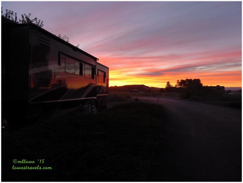
That’s a pretty sweet sunset at your site!
The Monument/Wedding Canyon Loop is one of my favorite hikes, but I prefer doing it in the opposite direction. We’ve also done Devil’s Kitchen and Serpents trail several times and it’s always a good workout. Glad you enjoyed Fruita as much as we do.
Wonderful natural places, excellent views! Thank you guys for your interesting post. H.J. 🙂