
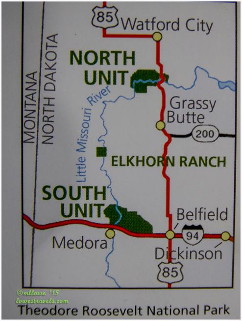
Our first outing at Theodore Roosevelt NP was a long hike at South Unit of the Petrified Forest loop trail in the Theodore Roosevelt wilderness (read here if you missed it). But that was only a piece of the sprawling 70,400 acres of the breathtaking North Dakota Badlands. The South Unit was close to our home base at Medora Campground (Steve’s review here), but it was a 60-mile drive to the North Unit, our next area of exploration.
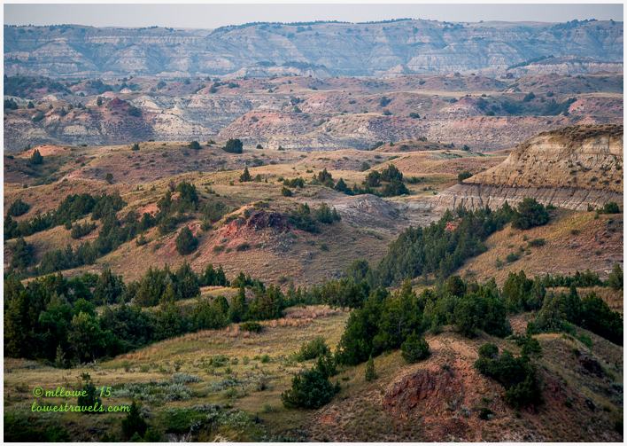
It was a good thing we visited the badlands areas on different days and at different times, for it gave us a variety of perspectives on the ever-changing mountain hues as the sun moved across the sky. As we approached each unit we were faced with colorful multi-layered mountains.
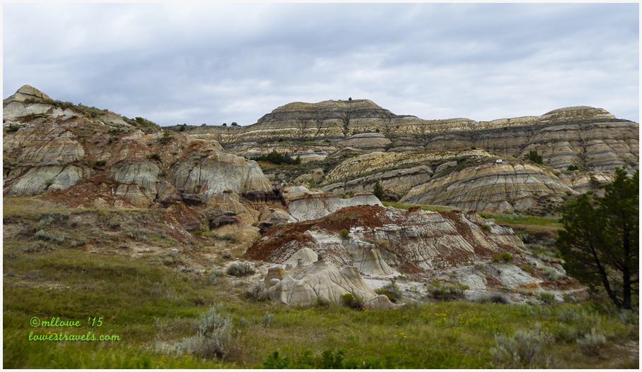
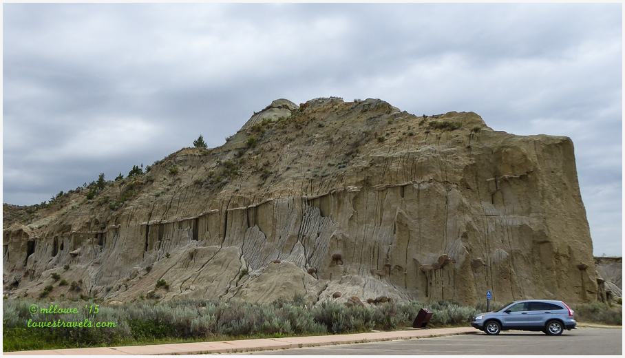
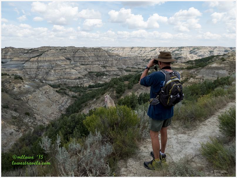
Winding down the scenic roads we began to understand why the badlands had profoundly affected Theodore Roosevelt. This landscape changes rapidly due to erosion by wind and rain. Many multi-colored horizontal stripes in the rocks run for miles. The corrugated cliffs, steep convoluted gullies and dome-shaped hills unfolded before us, and we were both fascinated and in awe of the beauty – so much to take in!

Creation of the badlands began over 65 million years ago. It occurred when the newly-arisen Rockies began depositing sediments that streamed here layer after layer. Six hundred thousand years ago the northward-flowing Little Missouri River, which was headed for Hudson Bay in Canada, was diverted east by glaciers. The change in flow eventually formed the rugged terrain that we saw today.

With the continuing erosion, colored layers of rock are exposed. They consist of layers of poorly lithified siltstone, claystone, sandstone, and lignite coal that were deposited in a coastal plain environment. When we looked around, common sedimentary sandstone was mostly what we see. But a closer look showed odd shapes and strange formations that we learned result from weathered sandstone that forms a protective cap of rock in some places called “hoodoos.”
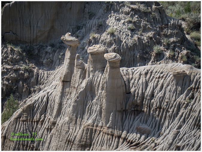
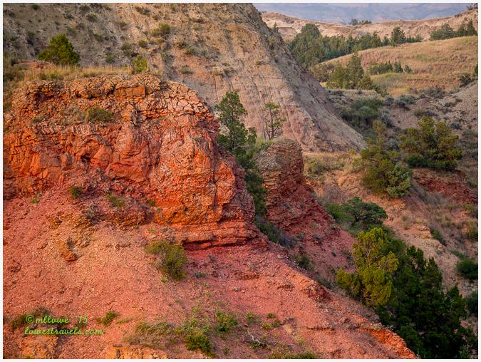
With erosion wearing down the less resistant material, a jumble of knobs, ridges, and buttes topped with durable red scoria caps remain

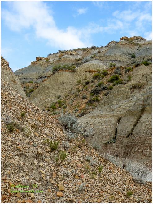
Geologic formations have always fascinated me, and from further reading I learned that the badlands are eroded mainly by “slope wash” not directly by streams and rivers. The soil and rock materials are easily weathered in places where vegetation is thin, forming a loose surface that slips and slides easily downslope during rain showers or when the snow cover melts.
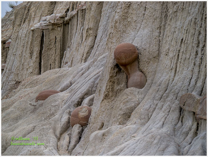
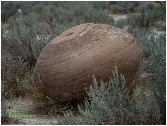
Concretions, on the other hand, are spheres of mineral matter once surrounded by rock of a different composition. The concretions in the picture below were formed when a cementing material formed around a center of organic matter such as a leaf, twig, shell or tooth. As the softer material weathers away, the spheres emerge as an apparently separate feature in the landscape. Isn’t that fascinating?

The horizontal layers of multi-colored sandstone, clay and shale are complimented by scattered beds of lignite coal and patches of pastel pink scoria. The pinkish color is created when the soft lignite burns in fires usually started by lightning, baking the surrounding clay to this bright color.

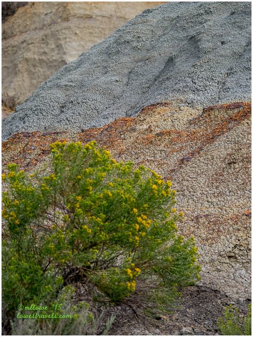
A closer look at the formations show bluish-gray layers of weathered volcanic ash that formed excellent marker beds in places. We also saw markers formed by brownish-gray layers of sand containing thin, orange iron-rich bands.
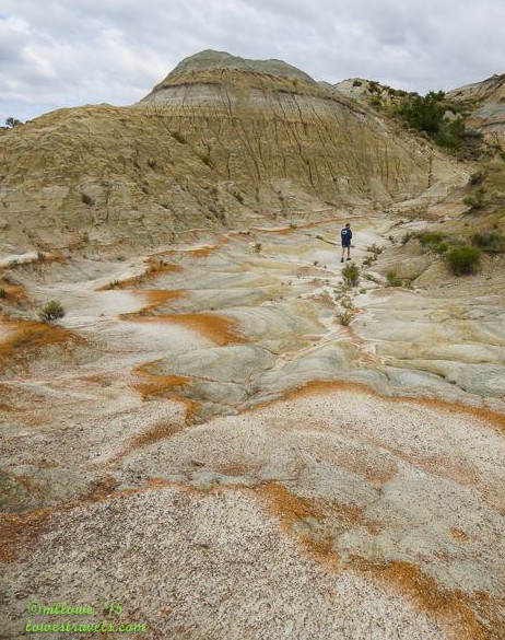
The badlands are a hilly landscape, and as we approached them at the South Unit we were looking down at them from above:

From one of the North Unit pullouts we saw plateaus capped with a blue-black popcorn-like soil called bentonitic clay which added even more color to the hills.
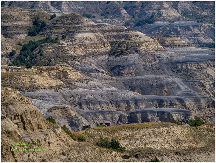
From the rim of “the breaks,” as the descent into the badlands is called, we viewed strips of sparsely-wooded ridges and bluffs.
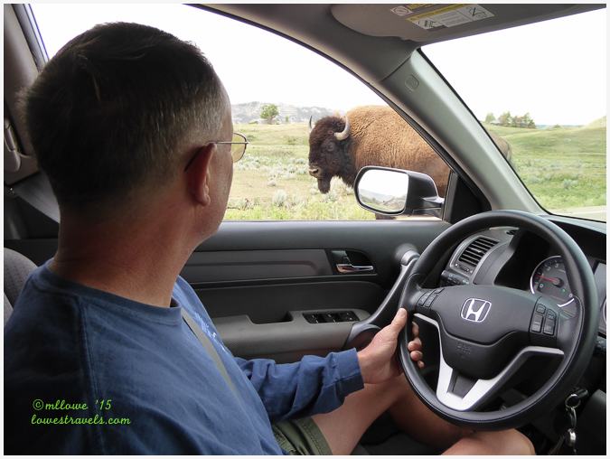
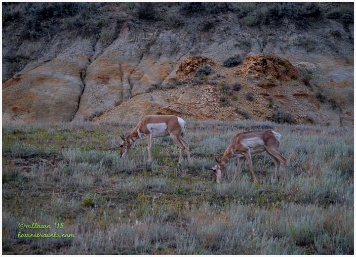
The badlands may look austere and desolate, but it is home to a dense population of wildlife. Bison and Prairie Dogs cause traffic jams, pronghorns can be seen on the hillside and wild horses munch peacefully in the meadows.
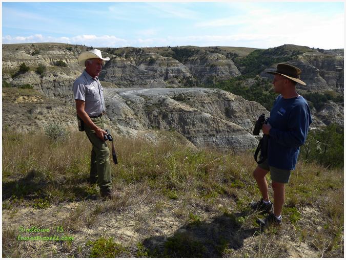
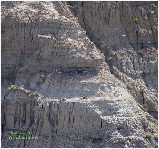
We didn’t see any Bighorn sheep until we ran across a park ranger who pointed out several on a distant cliff. He told us that 50% of the sheep here have died of pneumonia recently, and there may not be any left in a year or two. Very sad.
And of course I was excited to see several of my feathered friends!


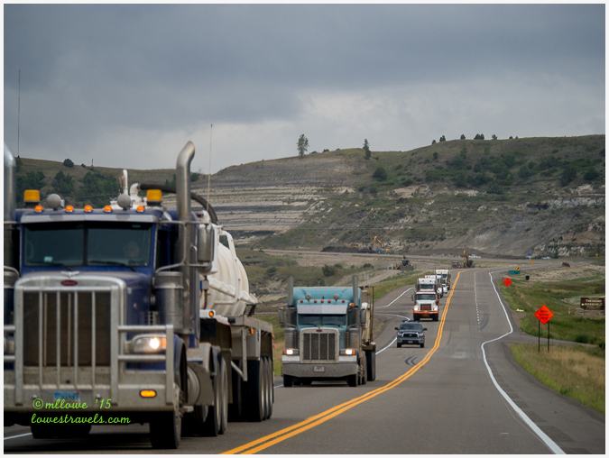
Amidst all of the breathtaking landscape in the North Unit is the reality of the oil boom in the Bakken Oil Fields just a few miles north of the park. We were surprised during our drive to the North Unit to see I-85 so busy with big rig traffic and speeding trucks.
While reading about fracking concerns I stumbled onto an interview of a defender of the North Dakota Badlands. It turned out to be none other than the ranger we had met at the park! Click here to learn about the realities of the oil drilling near the park.
Perhaps the best part of our hikes was the absence of one particular mammal – humans! Between the two areas of the park we preferred the North Unit, as it’s in a relatively isolated region and rarely crowded. While there we felt like we were experiencing the gorgeous loneliness of the badlands much as Roosevelt did more than a hundred years ago.

Comments
10 responses to “Why are the badlands so colorful? – Theodore Roosevelt NP”
WOW! What a beautiful post and so very informative! Your beautiful pictures of this beautiful NP make me want to drop everything and head that way!
What a spectacular landscape — the light at different times of the day definitely dramatically changes the colors. Thanks for the interesting link to the story about John Heiser — so tragic about the fracking and the changes it has brought to the park and surrounding areas. So shortsighted.
Such a beautiful area. Your photos are amazing and do such a great job showing the colors and all the different features in the rock. Aren’t the concretions just the coolest. It is so amazing to think that those balls formed in the walls. Love the hoodoos:) So glad you got to see some big horns. They are hard to spot for sure. So glad you and Steve, also, enjoyed North Dakota:)
Your post took me right back to the park. I spent much of my time there alone and found very few even on the trails in either of the units. I wanted to see bighorn sheep as well but they eluded me. Loved the concretions in the north unit and the dramatic geologic formations throughout the park. Great post!
Great post my friends! I’ve been to SD Badlands, had no idea how beautiful this one looks in ND. Thanks for the nice tour! 🙂
Fabulous post Mona Liza. Love your header of the Little Missouri and all the gorgeous pictures that so clearly show the geology you seem to understand so well. I am very impressed. We camped in both the north and south units for 10 days each and I don’t think in all my posts I did as good a job with explaining the geology. The fracking had just started and it was just heart breaking. I also am just so sad to hear about the sheep. Roosevelt would be so unhappy on both accounts, he loved the place so much.
One word…Gorgeous! Says it all.
Awesome post, Mona Liza. Very descriptive as to why the Badlands are the way they are. Thank you!
Truly fascinating and interesting land. You did a great job capturing the diversity of the land.
Absolutely gorgeous! I love the variety of colors and textures in the landscape. How wonderful to visit a place with so few other people!