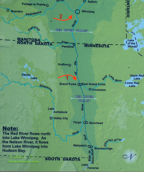
The Red River is one of the few major rivers that flow north. It originates at Lake Traverse in Minnesota and flows northward to Lake Winnipeg in Canada, forming the state border between Minnesota and North Dakota.
In my previous post we talked about the Canadian part of the Red River which forks with the Assiniboine River (marked as #2 on the map). On the U.S. side, the cities of Grand Forks, ND and East Grand Forks, MN is referred to as the Greater Grand Forks. This is due to its location at the fork of the Red River and the Red Lake River (marked #1 on the map).
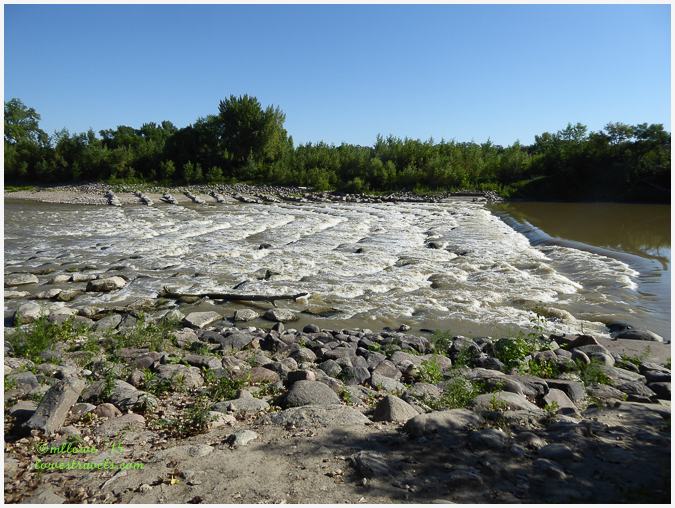


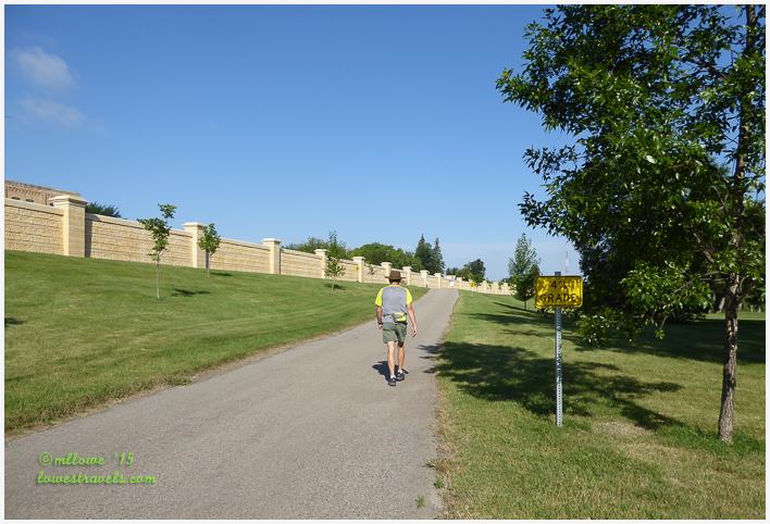
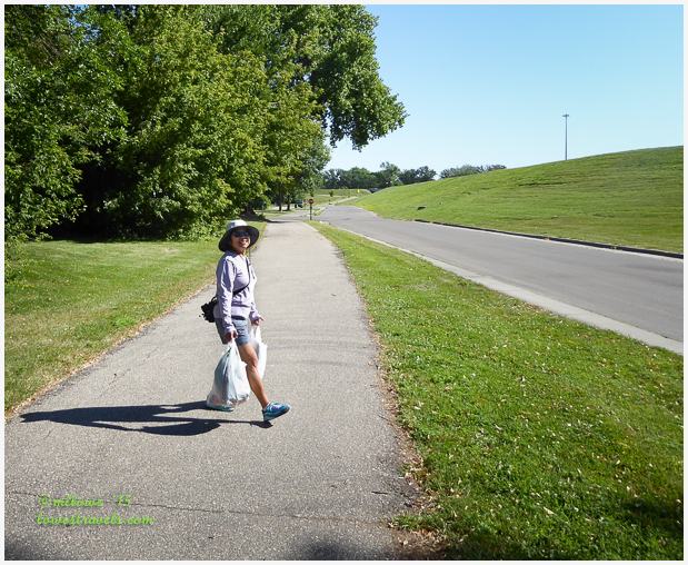
What were once entire neighborhoods bordering both sides of the rivers has been converted into a giant park called the Greater Grand Forks Greenway. This is where we took long walks during our visit on the Grand Forks side.

The transformation was especially visible in East Grand Forks, where we stayed at the Red River State Recreation Area RV park (Steve’s review here). It is located where one of the former neighborhoods stood before the 1997 event.

An “invisible” flood control wall has been built to protect downtown East Grand Forks. Its cutting-edge design provides the area with a view of the river instead of a dike. If a flood threatens, additional sections of wall can be added to provide protection to a level approximately four feet above the crest of the 1997 flood, which was a 500-year event. Openings in the walls provide vehicle and pedestrian traffic throughways.

During our stay we crisscrossed the bridges that connect the sister cities of Grand Forks and East Grand Forks. They have fully recovered and no visible signs of the devastating floods can be seen. We shopped at the Cabela’s located right across the street from the campground. It’s one of the large businesses that was confident enough to move into the area after the floods and subsequent upgrades.


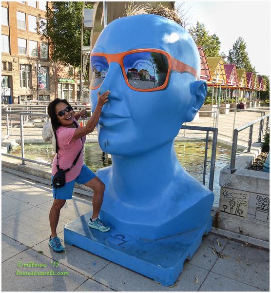
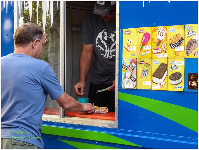
Besides walking and doing some shopping, I found time to goof off a bit…
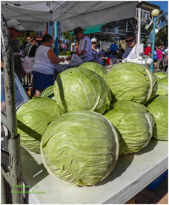
One of our favorite surprises is to run across a farmer’s market while walking around town, and that’s what happened on one of our Saturday morning treks. Among other things, we were amazed by the size of the cabbages for sale by one of the vendors.
We ended up with a bag full of fruits and veggies that was not part of our plan, but we enjoyed walking home with our bounty all the same.
Our tale of two forks in one river in two countries gave us some history lessons and several enjoyable experiences we won’t soon forget!
Comments
10 responses to “A Tale of Two Forks, pt. 2 – East Grand Forks, MN”
I cannot believe that high water mark. Glad to see that the city decided upon a safer use for the area instead of allowing homes to be build there again. We always love visiting the local farmers’ markets.
That was a crazy flood! Seems like a very good plan to make the area into a greenway instead of rebuilding homes in a flood-prone area. The flood control wall is ingenious. Looks like a beautiful RV park and excellent walking/biking paths!
Interesting to read about the history of this place, Mona Liza. Those cabbages are monstrous! Looks like you had fun there. 🙂
Wow…that 1997 flood was terrible. I don’t remember that terrible day. Glad to read that the recovery is complete.
I used to drive an ice cream truck. Every so often I would have an older person run me down. Glad Steve got his ice cream fix.
Really, you must be the friendliest ice cream truck driver!
I remember that flood. It was devastating. That year we drove back to IL for a visit and the flooding every where was just awful. Thanks for the tour 🙂
Wow that was a huge flood. The bridge picture makes it really clear. So smart of both cities to change what they allow on the waterfront rather than allowing people to build right back as they usually do after a natural disaster. Looks like a very interesting place to visit with blue busts sculptures with sunglasses and cabbages bigger than your head. Great post!
The city really studied hard on how to revived the stricken area. Fortunately the conversion works and we got to enjoy the MN side of the river.
Wasn’t this just the neatest area! We really enjoyed biking the Greenway and learning about the flooding in the area. They certainly have a great fix in place. This park was the perfect place to stay. Having rivers that flow north just boggles my mind.
Thanks to you, we checked your archives since I remembered you were here last year. I too can’t imagine a river flowing north but somehow some rivers do just that.