From Idaho we crossed into the far northeast corner of Oregon, with our sights set on the towns of Wallowa County – Joseph, Enterprise, Lostine, and Wallowa. When making our reservations in January we wanted to stay in the small town of Joseph, about which we’d heard great things. But apparently, a lot of other folks had heard great things before we had, so with everything booked up there we ended up at Wallowa River RV Park in the little town of Wallowa.
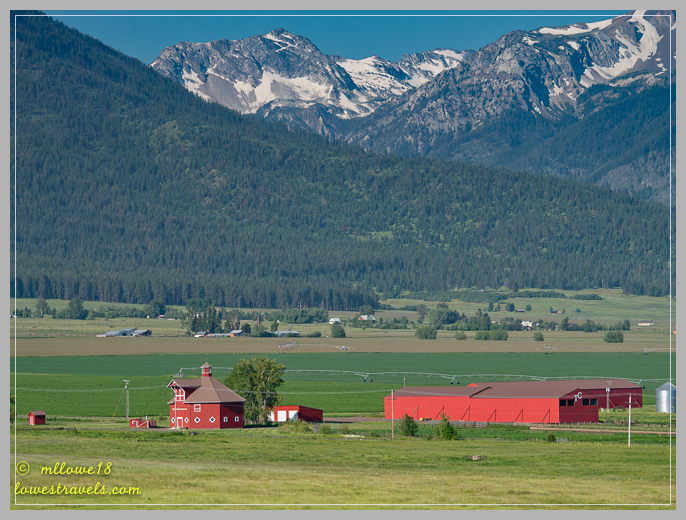
Although it meant we had to drive at least 25 miles to enjoy most activities in the area, our “commute” included Wallowa Valley, beautiful farmland, cool barns and wide-open skies – all against the backdrop of the jagged Wallowa Mountains.

The Wallowa Range has been dubbed the “Swiss Alps of Oregon”. Although we haven’t made it to Switzerland yet, we’ve seen pictures and could understand the comparison while driving along I-82. The range resides in the Nez Perce region (meaning “land of running waters”), and is home to 17 mountains that eclipse 9,000′. The Eagle Cap Wilderness features almost 360,000 acres of alpine peaks, meadows and lakes in the heart of what’s known as the Oregon Alps.

With so many things to see and do, our one-week visit had us on the move every day. That prompted me to divide our stay into two parts, sharing what we did each day of our stay. Besides, I took more than enough pictures to fill several posts!

Day 1 – A look at Joseph
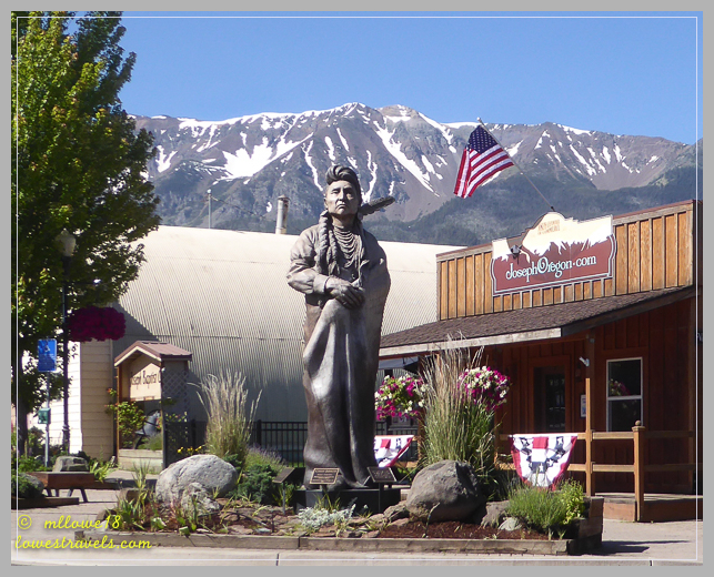
When we arrive at a new destination, we usually just chill out and research what we’re going to do during our stay. But here we already had lots of ideas from Wheelingit‘s 4-part series and Raven and Chickadee‘s post, so we were already off to a good start. Minutes after completing our setup we drove to Joseph to discover what the allure of this little town nestled at the base of the Wallowa Mountains was all about.

The town of Joseph is named after elder Chief Joseph, who was an esteemed leader of a band of the Nez Perce Tribe. We strolled through downtown in just a few minutes – it’s that small. So many things captured our eyes; life-size bronze sculptures, hanging flower baskets lining the streets and art studios all around. Although full of tourists, the vibe we got was simply of a small-town with many activities available nearby.
After ogling the many bronze statues adorning town, my body was gravitationally pulled through the front door of Arrowhead Chocolates – resistance was futile! Steve enjoyed a cup of delicious spicy Mexican Coffee, while I drooled over a decadent spicy Mexican Mocha…heaven!


Day 2 – Maxwell Lake, or not!
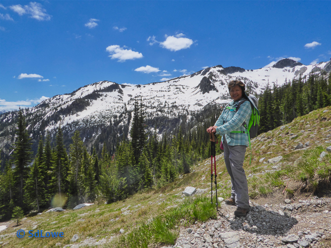
We quickly learned that most trails in the Wallowas are long and steep, and access to them is via dusty gravel roads. On our second day we opted to tackle the Maxwell Lake trail, nestled in a bowl of granite mountains. It began with a series of switchbacks for about three miles, then abruptly turned into a steep incline. The trail lead into fairly deep snow, and we eventually figured out that the lack of prior footprints meant we were done for the day. So we didn’t actually make it to the alpine lake, but we did get an excellent workout on a beautiful 9-mile roundtrip trek with a 2,500′ elevation gain.


Day 3 – Hell ain’t a bad place to be
Getting up super-early, we packed lunch, topped off our fuel, and headed toward the long dusty road to hell. Hell’s Canyon, that is!

The first 30 miles were on asphalt, Hwy 350 from Joseph to the tiny town of Imnaha. The fantastic hillsides along the way did not disappoint:

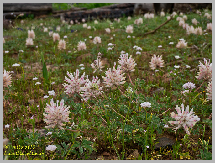
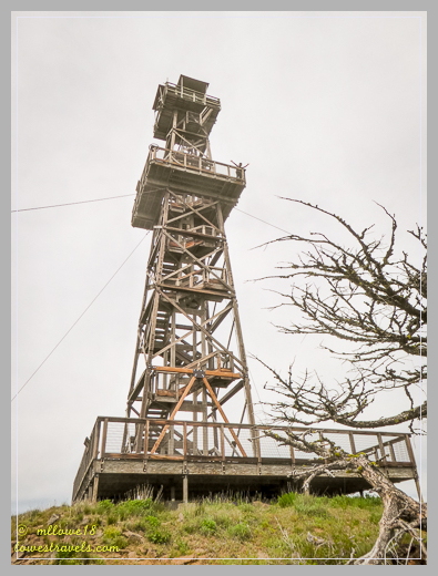
The gravel road began at “downtown” Imnaha, and we followed the steep (up to 16% grade) and sometimes single-lane road for about 6 miles. This was the most challenging section, but definitely do-able with a standard-height 2-wheel drive vehicle. After that it was a fairly easy jaunt on a well-maintained forest gravel road for the next 18 miles to Hat Point Overlook. The views along the entire drive were stunning, with wildflowers coloring the hillsides as a bonus!

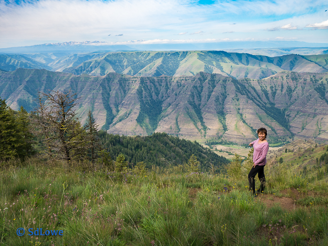


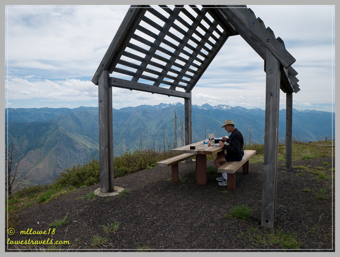
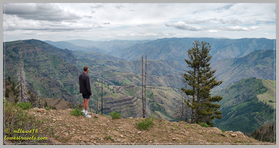
At Hat Point Overlook we saw a vast swath of Oregon and Idaho at the deepest river-carved gorge in the U.S. Created by the Snake River, Hells Canyon plunges more than a mile below Oregon’s west rim, and 8,000′ below snowcapped He Devil Peak of Idaho’s Seven Devils Mountains.

And what a view! The Seven Devils Mountains across the Snake River in Idaho rise to 9,300′, making the depth of the gorge nearly 8,000′. According to the NFS, the canyon was created from uplifting deep in the earth’s core that formed the Seven Devils and Eagle Cap Mountains, a process that continues today. The canyon itself is a result of both uplifting and erosion by the river.


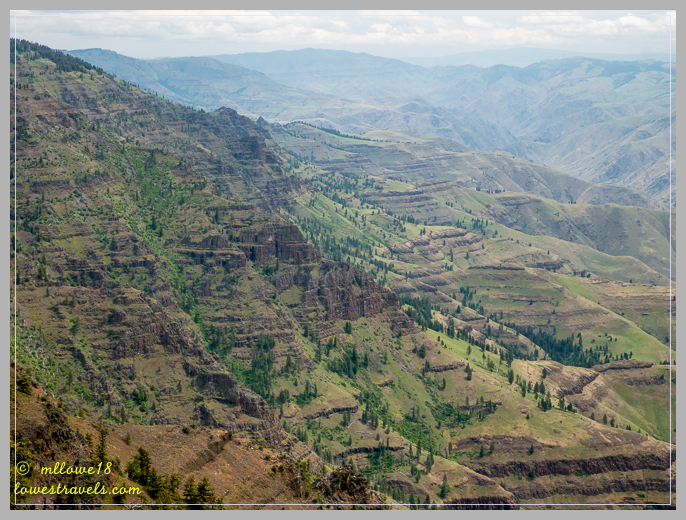
It was a long day of driving and gawking at the incredible canyons and wildflowers, and the effort was definitely well worth it. If you ever visit Joseph or this part of northeastern Oregon it would be a shame to miss it.

We love Joseph and the Wallowas, as you know! I’m so glad our post was helpful for you. It’s such a gorgeous area, and your photos and descriptions do it justice. I’m so happy you were there for the peak wildflower bloom—isn’t it spectacular? You even found a Calypso Orchid.
Next time we’ll try the Maxwell Lake Trail. It looks like a good one.
Wish I had one of those Mexican Mocha’s right now…one of the most delicious ever. Beautiful post, MonaLiza.
That would be Mexican Mochas. No apostrophe. I should always have my coffee before I do any writing, haha!!
It is really different when you experience it in person, pictures wont do justice. Thanks to your two posts we know what to do when we got here.
All these posts are so helpful when we visit new areas….thanks! I’ll also check out the other blogs you mentioned. Great post & gorgeous pics.
I would say, this part of Oregon is really breathtaking and is a destination.
Gorgeous header, MonaLiza!! We’ve never managed to catch the clouds below us like that. Sorry you didn’t get to the lake, but the hike to the snow was a great reward. What a drive! I want to get in the car and head there. Such spectacular views. We have said so many times that “you have to be here” to truly understand the beauty. Love the photo with the wildflowers and mountains. Cute orchid:) Keep those photos coming to feed my withdrawal.
Everything we did and see here were just fantastic. We could have done more hike had we parked closer to Joseph.
Simply stunning photos!
Thank you for stopping by.
Beautiful country for sure MonaLiza and your pictures are gorgeous ! I LOVE the meadows of wildflowers…a real treat you don’t get in any other season. Looking forward to Part 2 !
It is truly beautiful out here, maybe you swing by after your Olympic NP visit.
I still can’t believe we missed the Mexican chocolate when we were there. Beautiful photos once again
Thank you, sometimes the little things are overshadowed by stunning sceneries or too many activities.
We too love Joseph and the Wallowas. It has been great fun living vicariously through you RV bloggers but I am definitely ready to hit the road. Wish it wasn’t so bloody hot here right now.
Hi guys! Loved this post. We need to go there!
What a spectacular place… definitely on our must visit list.