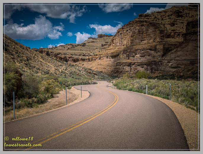
Our rule is to not drive more than 200 miles in a day, and so far in our six years of travels we’ve broken it only 3 times. But that was only because we were in Alaska and had little choice while trekking across the vast Alaska Highway wilderness. So when Steve realized the drive from Moab to North Salt Lake City was well over 200 miles, we decided to take a midway break at Price, UT.
While making the RV park reservation, we asked what there was to do in the area. The owner advised there were 10 museums nearby, along with six other activities in the vicinity – including several hiking trails. We went ahead and booked 2 nights so we’d have a full day to check things out.
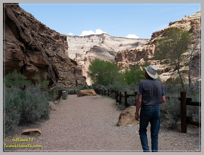
We opted to defer the museums for a return visit, and instead chose to enjoy one of the outdoor activities – driving through Nine Mile Canyon – which I recalled reading about in Jodee Gravel’s post.

I initially thought we’d be driving along and looking at a 9-mile long panel of rock art, when in fact it’s just part of a 70-mile backcountry byway. There are several theories of how Nine Mile Canyon got its name. An old one in 1869 says that John Wesley Powell’s cartographer (map maker) used a nine-mile transect system for mapping out the area. A more modern version refers to the 9th Cavalry, which built the road for better access to Fort Duchesne for the moving of troops and supplies. Either way, the Nine Mile Canyon name has stuck to this day.

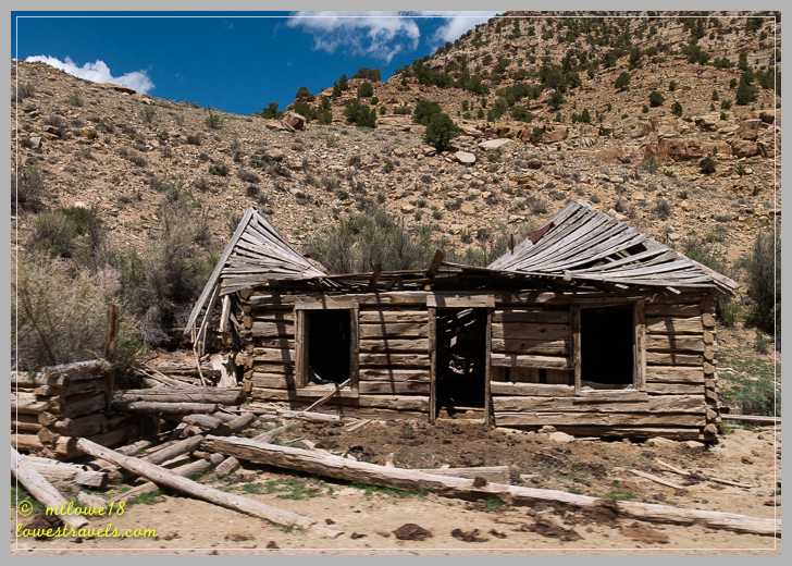
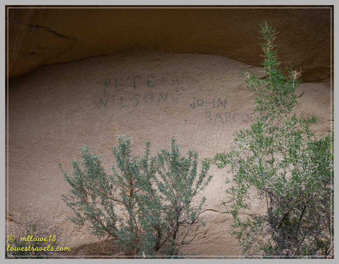
History says that in a span of 8,000 years or so there was a succession of people and cultures that lived and traveled through Nine Mile Canyon. They consisted of the Native Americans, the 9th Cavalry who built the road, freighters that hauled goods to Price from Uinta Basin, and settlers. Each left traces that included rock art, historic inscriptions, old homesteads and abandoned mines.
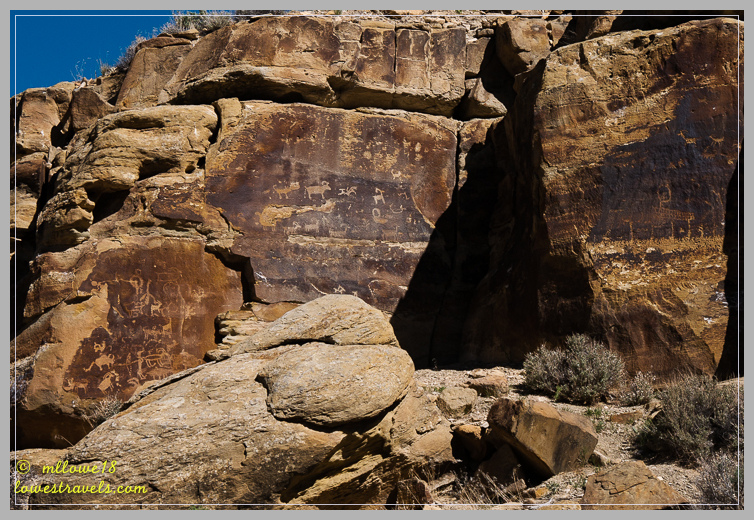
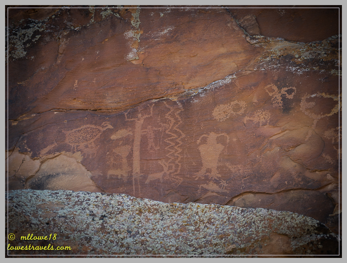
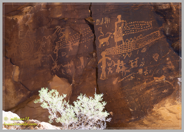
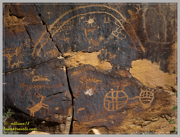
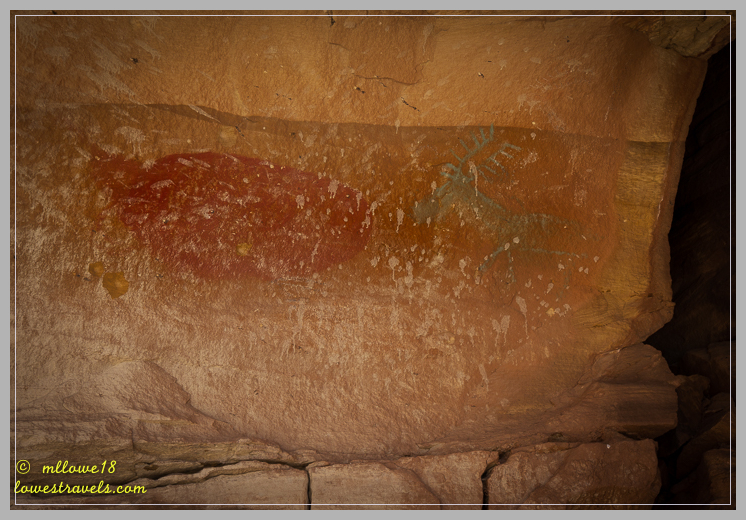
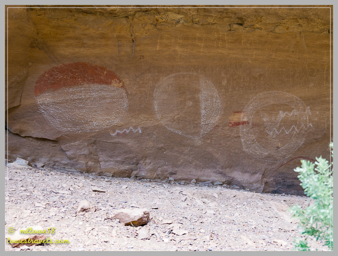
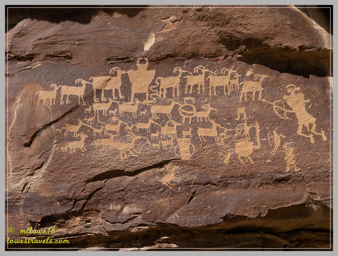
This post is about the petroglyphs (images carved/inscribed on a rock surface) and pictographs (symbols or art painted on rock surfaces) left behind along the canyon walls. Neither historians nor archaeologists have been able understand or interpret the messages they may impart. But for sure the abundance of this well-preserved legacy on stone is unique and irreplaceable.
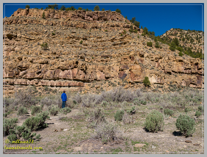
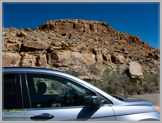
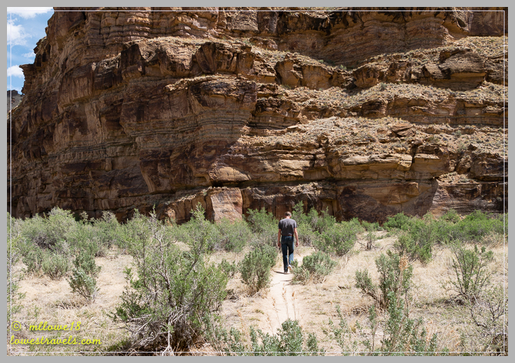
There were no signs in the canyon directing us to the sites, but with the help of this guide or this one we enjoyed trying to find them on our own. Armed with a mile-by-mile guide, we searched along the 50-mile stretch of rock art. Truthfully, the mile marker guide and map were less than in-synch, and we did a bit of head-scratching and back-tracking for a while – all part of the fun!


Cruising through the canyon, we drove slowly and looked carefully at all rocks with black patina on them. There were so many petroglyphs!
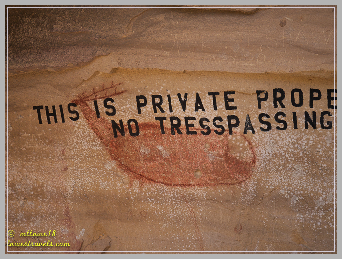
There were some more recent traces of people who also left their mark:


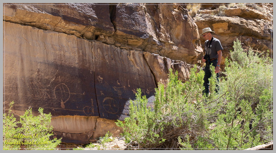
Some petroglyphs were distinct and others quite faint:

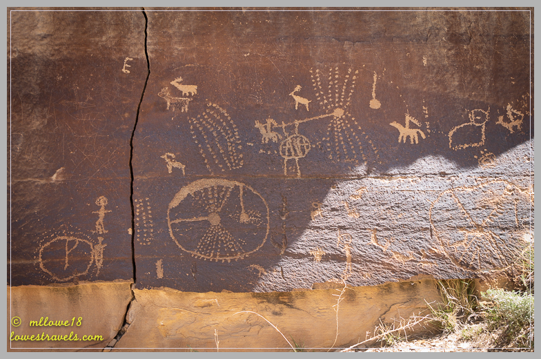
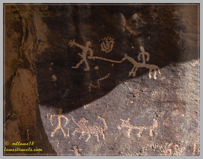


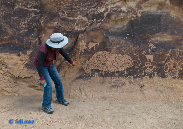
The highlight of all rock art here is the famous “Hunt Panel”, which is located near the end of the canyon at mile 45.9. This one can’t be missed, for it has a parking area with a kiosk. It holds one of the finest petroglyph panels we’ve seen, and it appeared in National Geographic magazine as the best example of Fremont rock art known.
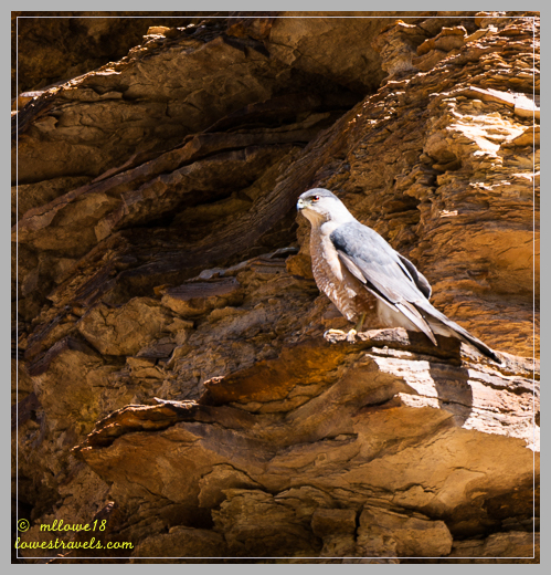
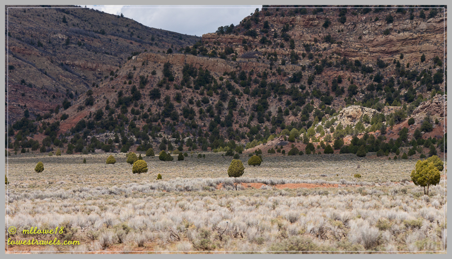
We had the canyon to ourselves, except for the wildlife monitoring us. There were three other canyon spurs that beg for exploration; Lower Nine Mile Canyon, Dry Canyon and Gate Canyon. But we’d had enough for one day, an interesting and relaxing drive with so much to see and think about!

What cool history in that area! Love the Pigs Head rock formation and all the art. Except for the one with “Private Property” marked over the art…I get that they don’t want any one in there but really?!?!
I know, we too were wondering what was he thinking?
Love your posts/pictures. Helps us decide on our routes. Hope everyone is healthy.
Thank you, let me know if you need details or some insights of places you may want to visit.
I so enjoy following your travels! I would LOVE to be on your journey! Keep sharing!
Glad you are enjoying it, and thanks for stopping by!
The no trespassing graffiti was depressing.
I know, we were wondering his thinking process was when he did that!
This area has been on my list for a long time. Having to search is part of the fun and adds some exercise. You found lots of interesting art. Good to keep the eyes open for those special rock formations…love the pig head. We may head this way on our way north this Sept. Thanks for sharing the drive!
September would be a good time to be there for it would be cooler. The visitor center (which we did not go) may have a good mile marker guide, if not the links I included on this post is workable.
Was not aware of all the petroglyphs and pictographs in that area (or the museums) despite having taken that route many times. Great photos. I love the collapsing cabin – I always take a pic of those or old barns. They are good habitat for birds and other critters, so people should leave them up.
Should you be passing this way on your down south, this is really a fun and interesting place to view.So many of them rock art!
In that area is also – Mc Conkie (sp) Ranch. As great as 9 mile is, Mc Conkie Ranch is even better. It is private land, but the owners provide parking and welcome the public to explore.
Hmm thank you, we will check that out for our next visit or when it is along our route.
It’s a WOW to be sure! We look forward to seeing it with our own eyes. Sometimes we find the most interesting things when we’re stopping only because of the mileage!
That is so true, most of the time we find hidden gems when we break our route such as this. Be sure to download from my links the mile marker guide or get a better at the Visitor Center before you go.
I cannot believe someone painted over that artwork. Actually, I can believe it. Which is even more depressing. Ugh…. Anyway, other than that, looks like some very cool finds. That balanced rock is just awesome!
I know we were sad and shaking our heads when we saw that blatant defacement.
way cool! im jealous!
Thanks for stopping by.
Very interesting rock art. That buffalo sure was big. You are much better at sticking to that mileage thing than we are. We should take note 😃
For me I would have not minded but when the captain says, 200mi is more than enough then we make do 🙂
ahhhh, I see you found something new for our list…
This was an interesting ” search and you will find ” exploration.
We are looking forward to Nine Mile Canyon. Thanks for the heads up on actually having to hunt for the walls…sure adds to the fun! I love the huge buffalo!
Yes, Gay download that two links I posted and perhaps also go to the Visitor Center. They may have a better mile markers.
Nine-Mile Canyon has been on our list for a while, too. And your photos have moved it up on our list! The rock art is fabulous. And so is the peregrine! But it really is depressing to see how those people defaced that gorgeous elk pictograph. It should be illegal to deface rock art, even if it is on private land. What’s wrong with those people?
It was fun hunting for the panels and if you go bring your lunch 🙂 I know seeing that defaced pictograph was a let down. All that property owner has to do is corral that area 😦
I’m really enjoying your blog. My goal is to one day full-time it myself.
Glad you are traveling with us and thank you for stopping by.
One more beautiful site to add to the list. Great post MonaLiza!
Very cool! I enjoy seeing these ancient works of art and pondering them.