Cody is in the heart of the “American West”, a gateway to spectacular driving loops that allowed us to see the best of Wyoming. We drove them until Steve threw up his arms and said ” enough driving already!” Armed with a color-coded map, we set up our driving strategy and took off!

Big Horn Mountains Loop/Wind River Canyon Scenic Byway (blue line)
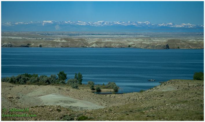
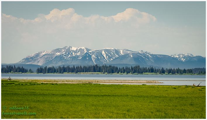
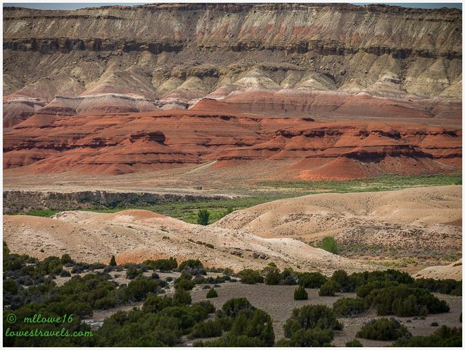
Coming here to our home base in Cody from the south, Betsy followed the western section of the Wind River Canyon Scenic Byway, a 34-mile route along U.S. Hwy 20 between Shoshoni and Thermopolis. Then we continued northwest on Hwy 120 through miles of broken range and badlands. It was a beautiful trek through some of Wyoming’s most amazing geology.


South Fork Road (purple line)
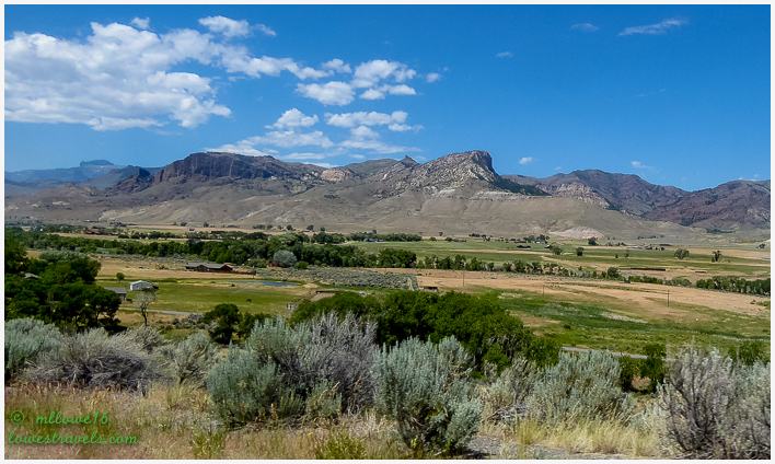
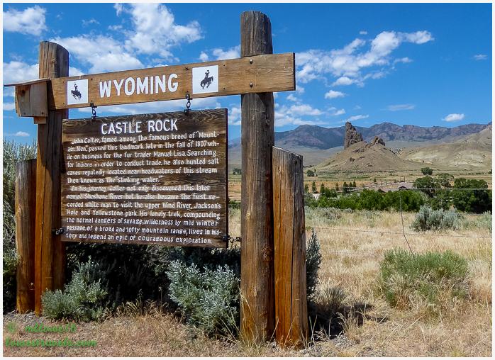
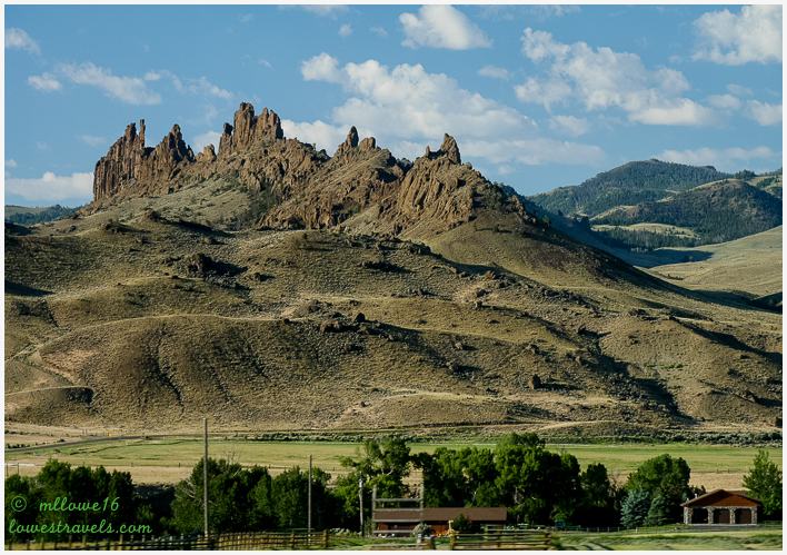
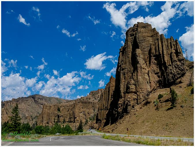
WYO 291 is also known as South Fork Road, and it begins off of Yellowstone Highway on the western end of Cody. It parallels the South Fork of the Shoshone River upstream through a scenic valley. Along the way are prominent volcanic rock formations like Castle Rock, and a succession of picturesque ranches. The road eventually dead-ends on the fringes of the Absaroka Range.
Castle Rock serves as a visual divider between the lower South Fork Valley and the more remote upper South Fork Valley. Around it are historic ranches and many exclusive private recreation properties.


Buffalo Bill Cody Scenic Byway (green line)
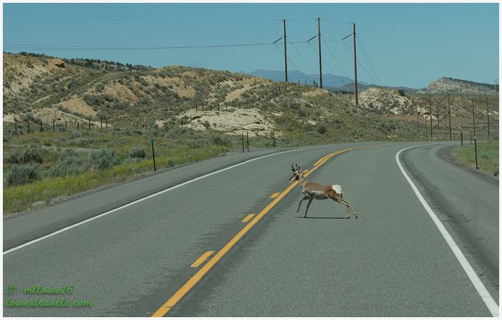
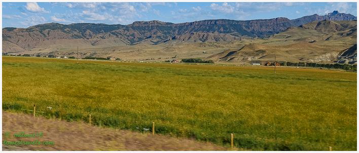
This stretch of U.S. Hwy 14-16-20 – also known as the Buffalo Bill Cody Scenic Byway – follows the north fork of the Shoshone River all the way to the east gate of Yellowstone National Park. For this scenic drive our destination was the eastern side of Yellowstone NP. Along the way in Wapiti Valley, we craned our necks at the high rugged rock formations. The valley is known for its wildlife, and although there were notices posted about grizzly bears we didn’t see any that day.
The byway entered Yellowstone NP at the head of the valley. It’s been ten years since our last visit here, so we thought it would be fun to revisit the oldest national park in the world.
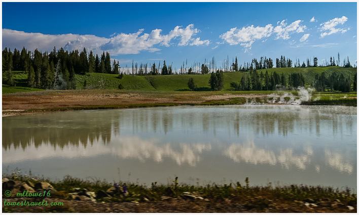
As to be expected, wildlife here is abundant and fortunately most critters shy away from people.


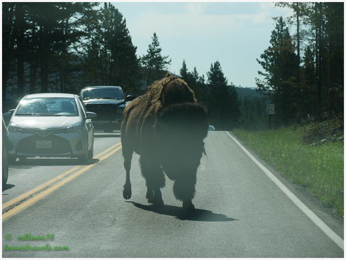
Visitors to Yellowstone NP can usually count on a traffic jam caused by the iconic Bison that live here. They aren’t shy!
Unlike our first visit here, it was crowded with heavy traffic by 10AM this time. We turned around after a stop at Hayden Valley in the park, which gave us a 190-mile roundtrip for the day.

This drive with breathtaking views as it snaked through Wapiti Valley and over Sylvan Pass into Yellowstone NP made the traffic in the park worth tolerating.
Chief Joseph Scenic Byway (green line)
Chief Joseph Scenic Byway forks off of WYO 120 about 20 miles north of Cody. It follows the route taken by Chief Joseph as he led the Nez Perce Indians out of Yellowstone National Park and into Montana in 1877 during their attempt to flee the U.S. Cavalry and escape into Canada.
The scenic highway climbs though fields of wildflowers and past Chugwater formations on its way into Shoshone National Forest.
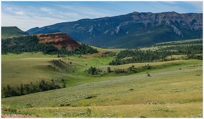
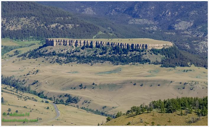
We pulled over at Dead Indian Pass (elevation 8,060′) to enjoy a dramatic panorama west into Sunlight Basin and north into Clarks Fork Canyon (unfortunately, due to a developing thunderstorm I caught only a glimpse of the 1,200′ gorge carved at Clarks Fork on the Yellowstone River).


The scenic highway ends at the bottom of the Beartooth Highway (U.S. 212), and we drove west up to Cooke City and east to the Wyoming-Montana border. I’ll do another post on that section, as we drove it from our next home base in Montana.
Bighorn Mountain Loop northeast end (orange line)
Taking U.S. 14A northeast toward Bighorn Canyon, we passed through irrigated farmland – a product of Buffalo Bill’s irrigation project – to the town of Powell. It’s the agricultural hub of northwestern Wyoming.
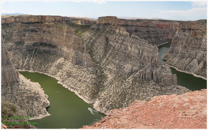
Our only stop here was at Devils Canyon Overlook:
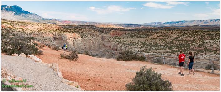
This overlook provides amazing views of the confluence of the Bighorn and Devils Canyons. The narrow, winding, colorful canyon cliffs tower 1,000′ above lake level.

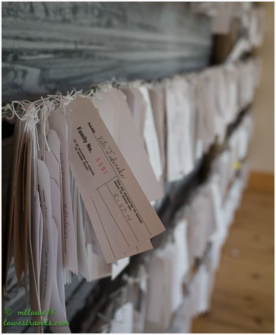
On our way back home we stopped at the National Historic Site of the Heart Mountain World War II Japanese-American Relocation Center. This was one of 10 relocation camps set up around the country to detain Japanese-Americans in the wake of the Japanese attack on Pearl Harbor.
We had visited the Manzanar Relocation Center at Lone Pine, California in 2012, and found the exhibits to be interesting and sad at the same time. This site near Cody memorializes the experience of more than 14,000 Americans of Japanese descent who were brought into and out of the camp between 1942-1945.

Bighorn Mountain Loop southeast end (orange line)
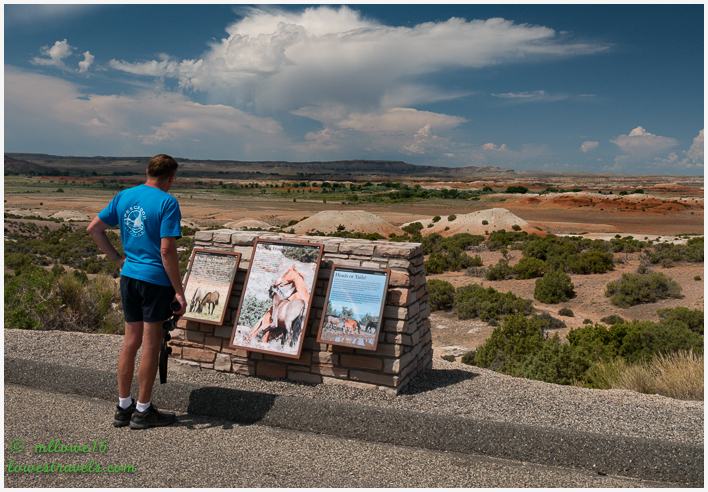
In a previous drive we were disappointed that we didn’t see wild horses at Pilot Butte Wild Horse Scenic Loop in Rock Springs, Wyoming. Here, I opted to join a private Wild Horse Tour, and for $33 I got a 2.5-hour viewing of the wild horses at McCullough Peaks Wild Horse Herd Management Area. The viewing area is 22 miles east of Cody on Hwy 14-16-20 at mile marker 72.

According to the guide, the objective of the Horse Management Area is to maintain a population of 100 wild horses. When over-population occurs, horses are removed and offered to the general public for adoption.
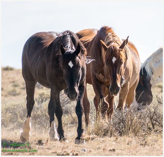
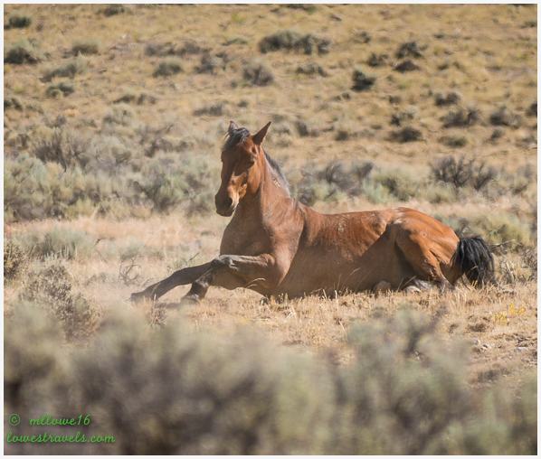
A wild horse as defined by federal law is unbranded, unclaimed and free-roaming on public lands. Wild horses and burros are descendants of animals that were released by or escaped from Spanish explorers, ranchers, miners, the U.S. Cavalry and American Indians.

Northwestern Wyoming is wild and scenic, and Cody is in the center of it all. Every road we took rewarded us with rugged canyons, spectacular mountains, lush ranch valleys and vibrant wildflowers adorning hillsides.
We’ll definitely be coming back to Wyoming – wild horses couldn’t keep us away!

I’m so glad you enjoyed your time in WY, my home state and I, in turn, enjoyed your pictures. However, the mountains across from Boysen Reservoir are the Wind River range.
Hope your ankle heals enough for you to hike up Cottonwood canyon in the Big Horns east of Lovell. My brothers and sisters helped geology students from Laramie find trilobite fossils one summer. My parents, my six siblings and I enjoyed many excursions to the mountains surrounding the Big Horn Basin–hunting arrowheads, stone tools; looking for fossils; picking chokecherries; fishing; picnicing; and, in general, being happy we lived in God’s Country!
Oh thank you for the catch, just fixed it. I really wanted to hike in the area but my knees were still healing up.
What awesome auto hikes you two had. That part of the country is outrageously beautiful.
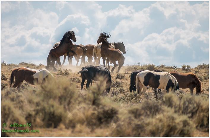
Oh my gosh…the fighting stallion photo is outstanding! Great job!
Thank you Marsha, thanks for my knees all we did here was just drive and boy were we glad. Wyoming is up there in terms of scenery and wide spaces.
I love seeing all the scenic drives you went on. The scenery there is just spectacular! The wild mustang photos are wonderful, especially the two stallions. Somehow we missed Cody during our western travels but many years ago we made a drive from Hardin, Montana to Bighorn Canyon at Yellowtail Dam. Is that were you stopped at the overlook?
Yellowtail Dam was further up north. The Devils Canyon Overlook was on south side of the canyon and really beautiful!
The stallion photo is outstanding, Mona Liza!
Hope your knee is better!
Thank you Jim, I was a happy photographer when I captured them fighting.
LOVE Wyoming and your photos really do it justice!
You captured all the beauty in your gorgeous photos:) We loved our visits to this area. The views are nonstop. Great photo of the stallions:) This was a perfect area to allow your knee to heal since there are so many drives.
Absolutely right, Cody was the perfect stop to keep my knees rested. Although there were trails that I would love to take on.
We love that area of Wyoming! Did not know about the Relocation Center, that is an interesting piece of history. Awesome shots of the wild horses!
Thanks, It was a very long wait until I got the shot. They were just standing around for two hours!
We love both Montana and Wyoming…such beautiful country! What an amazing photo of those stallions fighting. We recently saw a photographer’s work from the Pryor Mountain Wild Horse Range and know that we will go there some day. We drove through Yellowstone but decided against any hiking this time due to the crowds. We found plenty of great hikes in the Bridger Mountains.
We were really surprised to see how beautiful Wyoming is with the open spaces and great scenery.
I was lucky on the stallion shots, and it happened two hours of waiting.
We love both MT and WY, some of the most beautiful scenery around.
Holy smokes, that was a HUGE looking bison right in front of your car, did you have to wait long for him to move out of the way! I love love love the wild mustang photos, how amazing that must have been to see them in action. The photo you took of the internment tags is so very poignant, definitely made me sad to think about that.
We’re really hoping to hit Yellowstone next year, so this is definitely getting bookmarked by me so we can reference it next year! Thanks for all the great info.
Yes that big guy came right to us then walked on the sides and even winked at me. Oh thank you I was a happy photographer when I captured that one.
My only suggestion for your Yellowstone visit is start really really early.
Your tours of the area are wonderful! It’s so helpful to see the map of your journeys. When I first saw your photos of the mustangs, I thought the two stallions must be bronze statues commemorating the wild horses—and that the other horses were just hanging around the artwork. Those are absolutely amazing photos, ML!
I think a trip to Wyoming should be in your plan. You will like it here, there are lots of hiking trails and boon docking sites and very scenic.
I was lucky on the stallion photos and I think I was the only one in the group that got it.
Amazing! How many days did this take you-the drive and then to write it up? Fantastic photos! Send this to he Wyoming Chambe of Commerce….they should pay you for a great commercial on why we must go!
Thank you Debbie. I might just will 🙂
Some beautiful rides there, WY is on our list of places…one of these days. Great pics of the wildlife, love the horse pictures.
Nice of Wyoming to offer so many scenic drives for you to enjoy while you were out of commission for hiking. Love those wild horse photos … especially of the fighting stallions. That one reminds me of the sparring polar bears we watched on the tundra in Churchill.
Great shot of the stallions. We just love them.