Seeing Big Bend National Park by car gave us some broad impressions, but it wasn’t until we pulled on our hiking boots and followed some trails that we could really let the beautiful surroundings engulf us. Hiking is always our favorite way to experience places up close, and with hundreds of miles of opportunities to choose from, we couldn’t wait to get out there.
As usual, we tried to be among the first to get onto our selected trails each day, to beat the spring break crowds and the afternoon heat. But it turned out there were so many trails that we often walked for an hour or more without seeing another person. Now, that’s our kind of hiking!
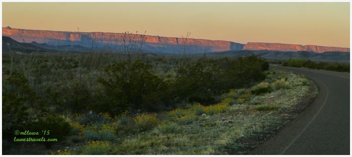
We managed to work in at least one trail from each of the park’s environments – desert, mountain, river and canyon – to get the full scope of what we could experience here. We also walked some short trails along the routes of our scenic drives. Most trails offered minimal to no shade, so we dressed in layers and brought plenty of H2O, along with our favorite snacks.
Be forewarned that this post is long, as I combined all of the hikes we took during our weeklong stay 🙂
So grab your favorite drink and enjoy the hikes and views with us.
Mountain Hikes
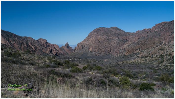
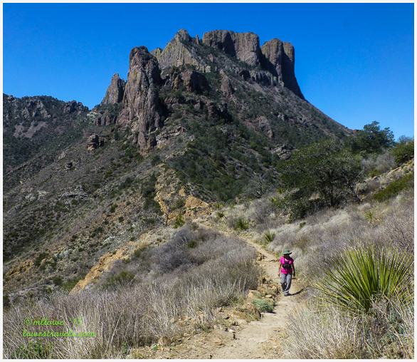
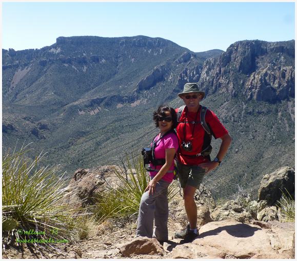
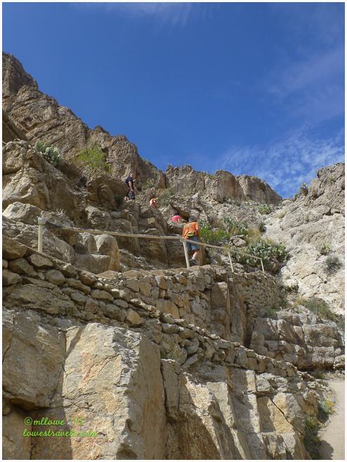
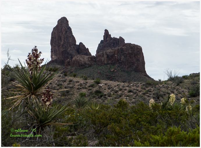
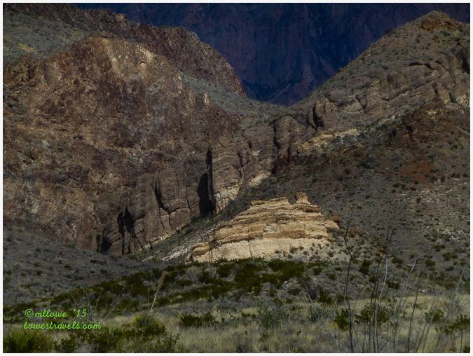
Our destination for these two hikes were at the Chisos Mountains, the heart of Big Bend National Park. The Chisos Basin is the hub for an extensive network of hiking trails, and here we chose the Window Trail and the Lost Mine Trail. Looking around the basin we saw spires, cliffs and great views of the entire erosion-formed area.
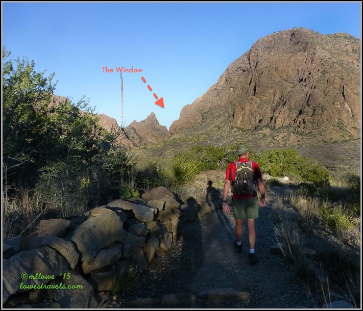
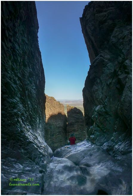
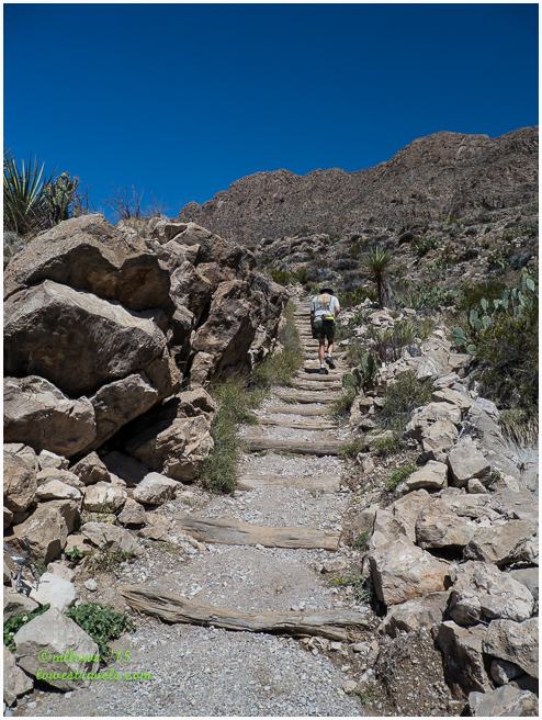
Our first hike was on the Window Trail, a 4.4mi. RT trek. It descends to the basin’s pour-off, the point where water drains out of the “bowl”, and into the desert far below.
As this was an early morning hike, the Cactus Wrens were there to welcome us before it got busy. Abundant plant life could be seen along the way, and up on the hills the Prickly Pear and Havard Agave were growing out of the rocks.


No question about where this trail ends – right at the very bottom of The Window, where an exquisitely carved water pour-off freefalls hundreds of feet to the desert below. We had our snack here to fortify ourselves for the 980 ft. elevation rise on the way back.
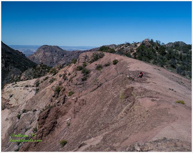
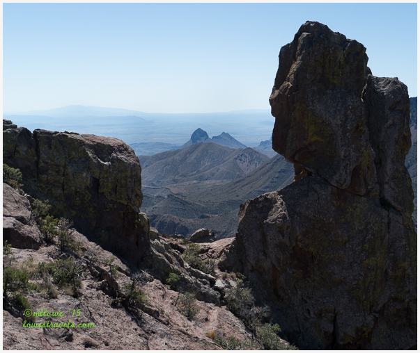
After a short break from completing the Window Trail, our second target for the day was the Lost Mine Trail. The 4.8 mi. RT hike gained 1,100 ft., climbing along ridges and switchbacks part-way up Lost Mine Peak. We enjoyed spectacular views of the surrounding mountains, canyons, and desert along the way.
The first 1/3 of this hike was a bit grueling, then the trail became a bit rockier about halfway through. We were huffin’ and puffin’ on this one, as it was one of our first serious efforts after months in the flatlands. It was also getting a bit warm out with no shade in sight, as we wrapped up our explorations for the day.
Looking closely at exposed rock outcroppings and escarpments, we noticed many surfaces covered with yellow, pink or black minerals that created a beautiful palette all around us.


The Lost Mine Trail ended at a dramatic rocky ridge at 6,850 ft., and after almost 2 1/2 miles of grunting and sweating our reward was stunning views in every direction.
River Hikes
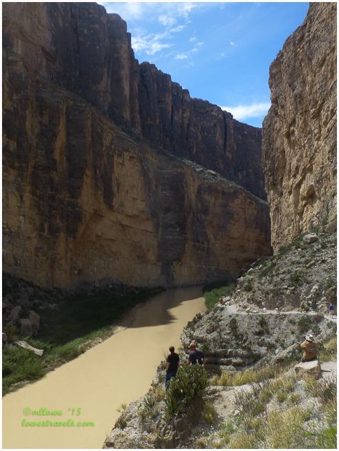
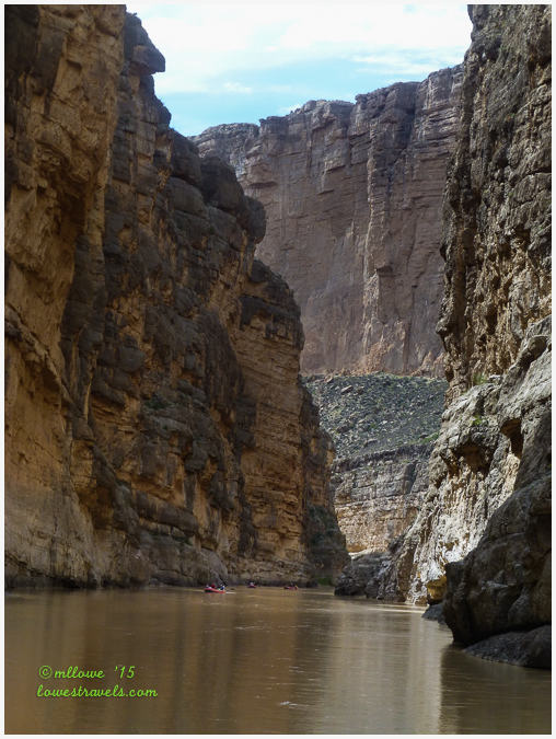
The Santa Elena Canyon Trail is probably the most popular hike in the park, and a must-do if you visit here. This moderately-strenuous 1.7 mi. RT trail is located at the end of the Ross Maxwell Scenic drive. The ascent began with a climb up several paved and stepped switchbacks, passing a sheer cliff at the opening of the gorge. That was followed by a more gradual descent back to water level, where the trail eventually ended a ways up the towering canyon.
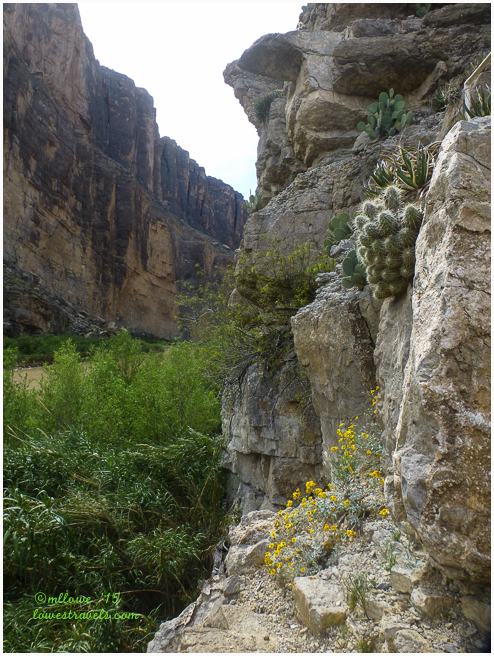
At the beginning/end of this hike, a flat section of several hundred yards leads between the parking lot and the gorge, traversing a beach and leading onto a path through some greenery. Unfortunately, recent rains in the area can swell Terlingua Creek and cover the beach, making it – and the canyon trail – impassable.
On the day we went there were no problems, but two days later a rain had shut this hike down. A total bummer for a lot of people wanting to see the canyon!
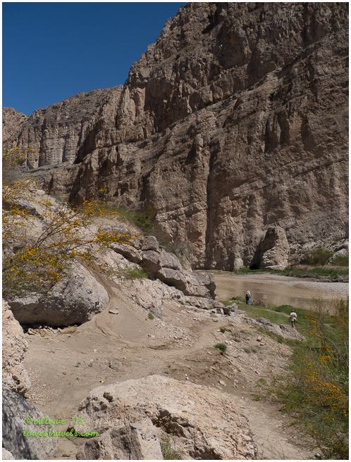
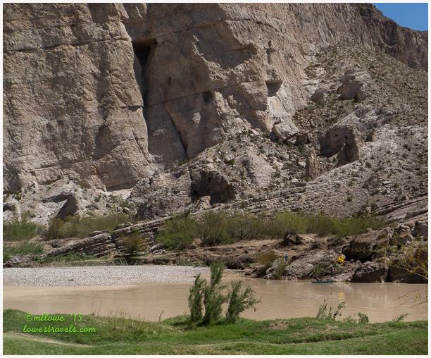
The Boquillas Canyon Trail is an easy 1.4 mi. RT hike that goes into the mouth of Boquillas Canyon. We walked up a small hill and then descended toward the river and the canyon, over sand and rocky pathways.
The approach was quite dramatic – the high, layered cliffs around the river are topped by huge, angular mountains on the Mexican side of the river. Although impressive, it’s not as wow-inducing as the more popular Santa Elena Canyon. But it is a ways off the beaten path and therefore less crowded.
We learned that throughout much of the Rio Grande’s history, the border along the river here has been fluid, allowing people of both countries to come and go as desired. But with all of the social and political pressures over the years, border restrictions have been affected and the legal crossings in this area are allowed only 5 days per week.
Loss of income on the Mexican side has led shrewd hawkers to leave small souvenir stands along the trail on the U.S. side. The mexican “salesmen” sit along the bank across the river, and if a hiker wants to make a purchase the salesman quickly paddles across the river in a small rowboat to make the transaction.
Although the practice is illegal, they are probably harmless and just trying to make a few bucks from the hikers.


Desert Hikes
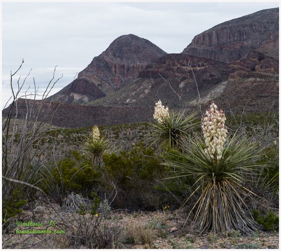
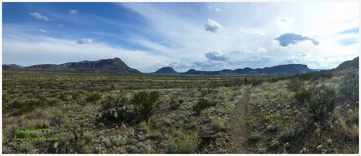
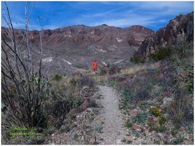
The Mule Ears Spring Trail is a moderate 3.8 mi. RT that meanders along the Chihuahuan desert. So named because the twin pillars of black igneous rock towering above the desert resemble a mule’s ears, it was once part of a volcano’s core.
The trail winds through dry washes and across rolling Chihuahuan desert terrain. We were glad to be there on a cloudy day, as we could have received a pretty good roasting from the sun during this hike.
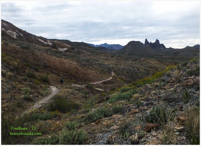
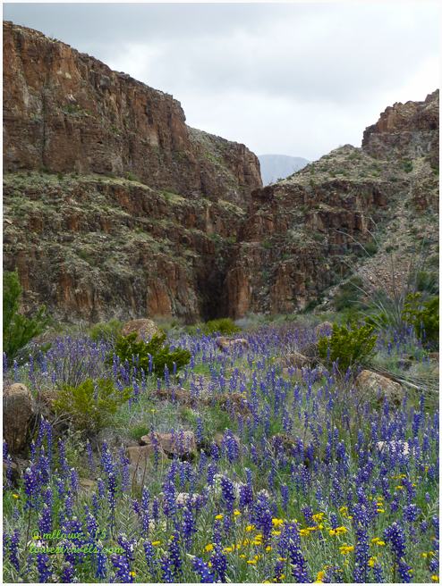
Being springtime, various cacti like the Torrey Yucca, Ocotillo, Sotol and Prickly Pear were in full bloom.
This was one of my favorite trails, as wildflowers painted the desert floor and the timing of our visit was just perfect to gush over the flowers.


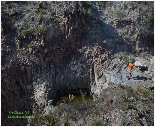
Our final desert hike was on the Burro Spring Trail. We decided to follow this 1.5 mi. RT trek on a spur of a moment at the end of the day. We convinced ourselves we could do one last quick hike, so we followed a dry wash that ended at the bottom of the dramatic Burro Mesa pour-off.
At the trailhead we thought this was just an easy walk so we didn’t bring water. Big mistake, at 4pm the sun was still blazingly hot and there was no cover from the heat. By the time we got back to our car both of us were gulping cold water as fast as we could.


Because the mesa above where we followed the trail was capped by hard lava, the runoff sculpted a sheer chute instead of a leisurely stream canyon. At the end of the trail we were looking down an impressive 3-part 80 ft. waterfall that was dry at the time.
At Big Bend Ranch State Park
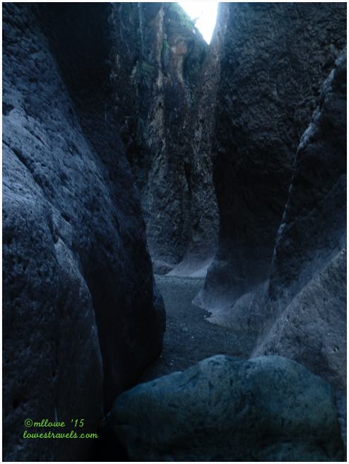
Although the Closed Canyon Trail was actually located at nearby Big Bend Ranch State Park, I decided to include the hike in this post. We originally wanted to tackle this one on the day we drove through the state park, but an incoming thunderstorm stopped us cold. Flash floods can be dangerous here, and we drove through several small streams already crossing the roads as we hurried out of the park and back home in heavy rain.
But we had heard so many good things about this canyon that we got up before dawn on the day we had to leave and made a special trip back out just to see it. An easy walk with increasingly difficult obstacles (ie. large boulders) along the way, we walked as far into the canyon as we could, completing the 1.7 mi. RT exploration. We’re really glad we did!
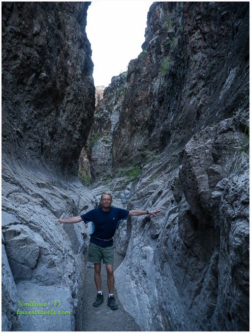
Closed Canyon is a deep, narrow cut through Colorado Mesa to the Rio Grande. It’s the result of seasonal stream flows from the desert that have continued to deepen it. Less than 10 ft. across in some places, the 150 ft. deep canyon is one of the state park’s most impressive features.
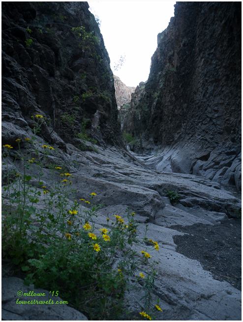
 Closed Canyon gets its name from its narrow width; in some places we could span the entire “gorge” by just holding out our arms.
It seems from this post that we covered a lot of ground in a week, and we did, but the reality is we barely scratched the surface of this vast park. And another thing to note is that since our home base was outside the park, each hike included a substantial drive to its starting point. My only beef was that the brochure boxes at the trailheads were always empty, and we could not figure out what a lot of the numbered posts along the way were meant to explain.
But the adventure continues…

Absolutely stunning pictures! Fabulous details….we now know we’re going to follow in your footsteps one days. Great post! Thanks!
Getting to Big Bend is really a big decision to make because it is really out of the way from anything else.
Wow you guys did a lot! I just love the variety here. I’m so glad you are there at the time of the flowers. It couldn’t get much better than that. I tried to decide which of your pictures I like the best but it was impossible. Each hike had such great photos. The river looks like a nice cup of cocoa. Great post. It was a really fun read.
Imagine me looking at al the hundreds of pictures I took. It was a challenge that I finally gave up and just pick the one I thought would best represent the terrain we were hiking in.
Looks like you made very good use of your time there! Love all the variety and the flowers! Spring in Texas is pretty darn nice!
A week was not enough despite doing something everyday. But it was really getting hot here that the hikes has to be done first thing in the morning.
And yes, perfect timing of all the wildflowers and cacti blooming in the desert.
I’m thinking a week at Big Bend is not nearly enough! You guys sure packed in a lot of hikes and WOW!
Beautiful photos MonaLisa….especially liked the Cloaed Canyon!,
Gay, with your jeep, you can go to areas that we were not able to. I hope you can make a stop here.
So glad to see those hiking shoes getting a workout. Stunning country and I especially like all the wildflowers. Thanks for taking us along on your hikes. BTW…. I like Steve’s new socks. Thumbs up 😉
Steve says thank you 🙂 he is adjusting to it. Make this one of your stop next year so you can experience the difference between the Sonoran Desert that you had been enjoying and the Chihuahuan Desert.
You do such a good job of describing the trails and photographing the points along each hike. This post is a keeper for sure! I would love to do those hikes!
BB might be in Texas and remote, but is worth your while. And lots and lots of hiking too.
What an outstanding week of hiking! That is such a beautiful area. Doesn’t look like Texas. You certainly put on the miles but I totally understand the need to see everything you can in the time you have. So many deep canyons! Love that slot area in the SP. Glad you had some beautiful springs blooms to add to these great hikes. You two look like so happy to be back on the trail:)
Oh yeah, this was our very active and happy stop! I hope one day Pam you will make this a destination, as this is the part of TX worth stopping for. The diversity of rock formations is amazing plus your jeep can go where we were not able to. Lots of hidden gems too.
My Pinterest got a work out today. All of the hikes are great. You two saw so much beauty on these hikes. We like the idea of breaking up the hikes..desert, mountain, river and canyon. Great idea.
Thanks for sharing all the hikes. It will help us when we get there, hopefully, next January.
Marsha, lots of choices and every trail has its own characteristics to admire.
Hi, guys — always enjoy your posts. Question: do you think these hikes would be safe for a middle aged lady to do by herself? I’m planning to hit the road in a few years but was wondering if exploring these trails by myself would be OK. Thanks!
Carol, glad you are enjoying our hikes and other posts. We have encountered a few ladies hiking by themselves but usually on popular trails and on state and national parks. When the time comes and you are planning a hike that we had been just send me a message and Ill give you some ideas.
We have been enjoying your Big Bend posts, Mona Liza! We had no idea that area was so rugged and so beautiful.
Diana went back to your posts on chiggers yesterday after I got into them in the Everglades. Luckily, they are only on my feet and ankles. I am having to drive the rig back to Michigan barefoot, though. Those little buggers are nasty! 🙂
Jim
Chiggers! nasty nasty! IF they are on your feet and ankles it might be the gnats or something else. Ive got a lot of bites also while in Florida last year. Chiggers attack your belly area.
Great post MonaLiza. We loved our time at Big Bend and did many of the same hikes, although you certainly introduced us to a few more. Glad you are feeling better. 🙂
Thank You LuAnn, a week here was not enough there are still hidden gems we have not explored.
What a great idea to do a variety of hikes to experience all of the different terrains. It seems like each one is on such a grand scale! Looks as though you were in Big Bend at the perfect time, while the wildflowers are blooming and before it gets too hot. Thanks for all of the wonderful hiking tips. We’ll be following in your footsteps next year!
A week stay was not even enough 🙂 Lots of hiking and birding too more so now that spring migration is underway.
Thanks for scouting out BB for us … hope to be there next winter.